
File:Usa edcp relief location map.png

Saizi ya chakuona ichi: 800 × 495 pixels. Mu misani inyake: 320 × 198 pixels | 640 × 396 pixels | 1,181 × 731 pixels.
Chinthu cha kwenekuko (1,181 × 731 pixels, file size: 1.56 MB, MIME type: image/png)
Mwakudumula
| Malongosolelo |
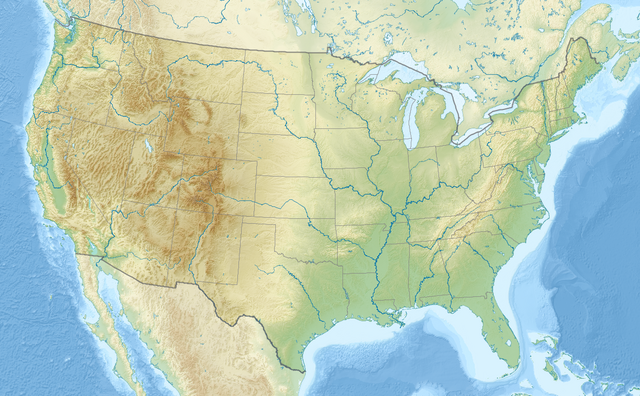
English: Relief location map of the USA (without Hawaii and Alaska).
EquiDistantConicProjection : Central parallel : * N: 37.0° N Central meridian : * E: 96.0° W Standard parallels: * 1: 32.0° N * 2: 42.0° N Made with Natural Earth. Free vector and raster map data @ naturalearthdata.com. Formulas for x and y: x = 50.0 + 124.03149777329222 * ((1.9694462586094064-({{{2}}}* pi / 180))
* sin(0.6010514667026994 * ({{{3}}} + 96) * pi / 180))
y = 50.0 + 1.6155950752393982 * 124.03149777329222 * 0.02613325650382181
- 1.6155950752393982 * 124.03149777329222 *
(1.3236744353715044 - (1.9694462586094064-({{{2}}}* pi / 180))
* cos(0.6010514667026994 * ({{{3}}} + 96) * pi / 180))
|
| Siku | |
| Ukaboni | Chinthu chane |
| Mlembi | Uwe Dedering |
| Other versions |
|

Chilolezo
I, the copyright holder of this work, hereby publish it under the following licenses:
Chinthu ichi ntchakuzomelezgeka na Creative Commons Attribution-Share Alike 3.0 Unported license.
- Ndimwe ŵakuzomelezgeka:
- kugaŵa – kuti mutandazge, kugaŵa na kusintha ntchito
- kusazga – kusintha chito iyi
- Pa malango ghakulondezga agha:
- Viyambilo vya kuchita – Mukwenela kupeleka malumbo ghawemi, kupeleka linki yakutyonda ku chilolezo, kweneso yowoyaniso pala vinyake vyasintha. Mukwenela kuchita nthena mwakwenelela, kwambula kujikhalila khonde.
- mwa kugaŵana – Pala mwasazga panji mwasintha chinthu, mukwenela kuchitandazga

|
Chilolezo ntchakupelekeka pakupanga copy, kutandazga panj kusintha na malango gha GNU Free Documentation License, Version 1.2 or any later version published by the Free Software Foundation; with no Invariant Sections, no Front-Cover Texts, and no Back-Cover Texts. A copy of the license is included in the section entitled GNU Free Documentation License. |
You may select the license of your choice.
Mbili ya chinthu
Dofyani pa siku/nyengo kuti muone umo vikaonekela pa nyengo iyo.
| Siku/Nyengo | Kachithuzi | Vipimo | Mgwiliski | Ganizo | |
|---|---|---|---|---|---|
| sono | 20:50, 2 Epulelo 2024 | | 1,181 × 731 (1.56 MB) | Spesh531 | correction to Rhode Island border. Little Compton and Tiverton was previously shown to be in Massachusetts |
| 16:32, 23 Disembala 2016 |  | 1,181 × 731 (1.47 MB) | Jeanjung212 | Lossless Compressed/optimized png decreasing file size by 193731 bytes | |
| 10:37, 24 Ogasiti 2010 |  | 1,181 × 731 (1.66 MB) | Uwe Dedering | {{Information |Description={{en|1=Relief location map of the USA (without Hawaii and Alaska). EquiDistantConicProjection : Central parallel : * N: 37.0° N Central meridian : * E: 96.0° W Standard parallels: * 1: 32.0° N * 2: 42.0° N Made with Nat |
Magwiliskilo ntchito
The following 8 pages use this file:
Umo chinthu chagwiliskikila ntchito
Ma wiki ghanyake agho ghakugwiliska ichi:
- Magwiliskilo pa ab.wikipedia.org
- Magwiliskilo pa ace.wikipedia.org
- Magwiliskilo pa als.wikipedia.org
- Magwiliskilo pa ang.wikipedia.org
- Magwiliskilo pa ar.wikipedia.org
- قالب:خريطة مواقع
- قالب:خريطة مواقع/شرح
- قالب:خريطة مواقع الولايات المتحدة
- قالب:خريطة مواقع الولايات المتحدة2
- قالب:خريطة مواقع/ملعب
- وحدة:Location map/data/USA
- وحدة:Location map/data/United States
- وحدة:Location map/data/USA/شرح
- وحدة:Location map/data/United States of America
- كلية مونماوث
- وحدة:Location map/data/United States/شرح
- وحدة:Location map/data/United States of America/شرح
- بوينغ فيلد
- جامعات أمريكية حسب عدد الملتحقين بالمرحلة الجامعية
- جامعات الولايات المتحدة حسب عدد المسجلين
- فورتشن 1000
- تكوين هيل كريك
- انفجار صاروخ تيتان في داماسكيوس 1980
- تحطم طائرة بوينغ بي-52 في قاعدة فيرتشايلد الجوية
- Magwiliskilo pa arz.wikipedia.org
- Magwiliskilo pa ast.wikipedia.org
- Magwiliskilo pa as.wikipedia.org
- Magwiliskilo pa av.wikipedia.org
- Magwiliskilo pa azb.wikipedia.org
Wonani magwiliskilo ghanandi ghapa charu gha chinthu ichi.