
File:Ukraine under russian occupation grey.svg

Size of this PNG preview of this SVG file: 800 × 538 pixels. Mu misani inyake: 320 × 215 pixels | 640 × 430 pixels | 1,024 × 688 pixels | 1,280 × 860 pixels | 2,560 × 1,720 pixels | 3,780 × 2,540 pixels.
Chinthu cha kwenekuko (SVG file, nominally 3,780 × 2,540 pixels, file size: 1.8 MB)
Mwakudumula
| Malongosolelo |
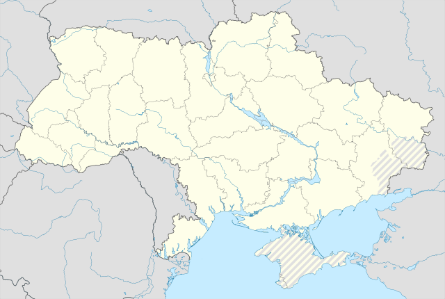
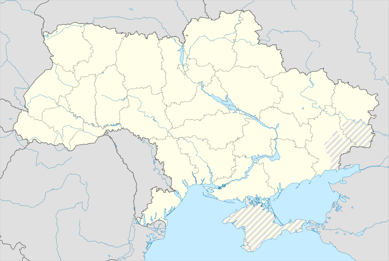
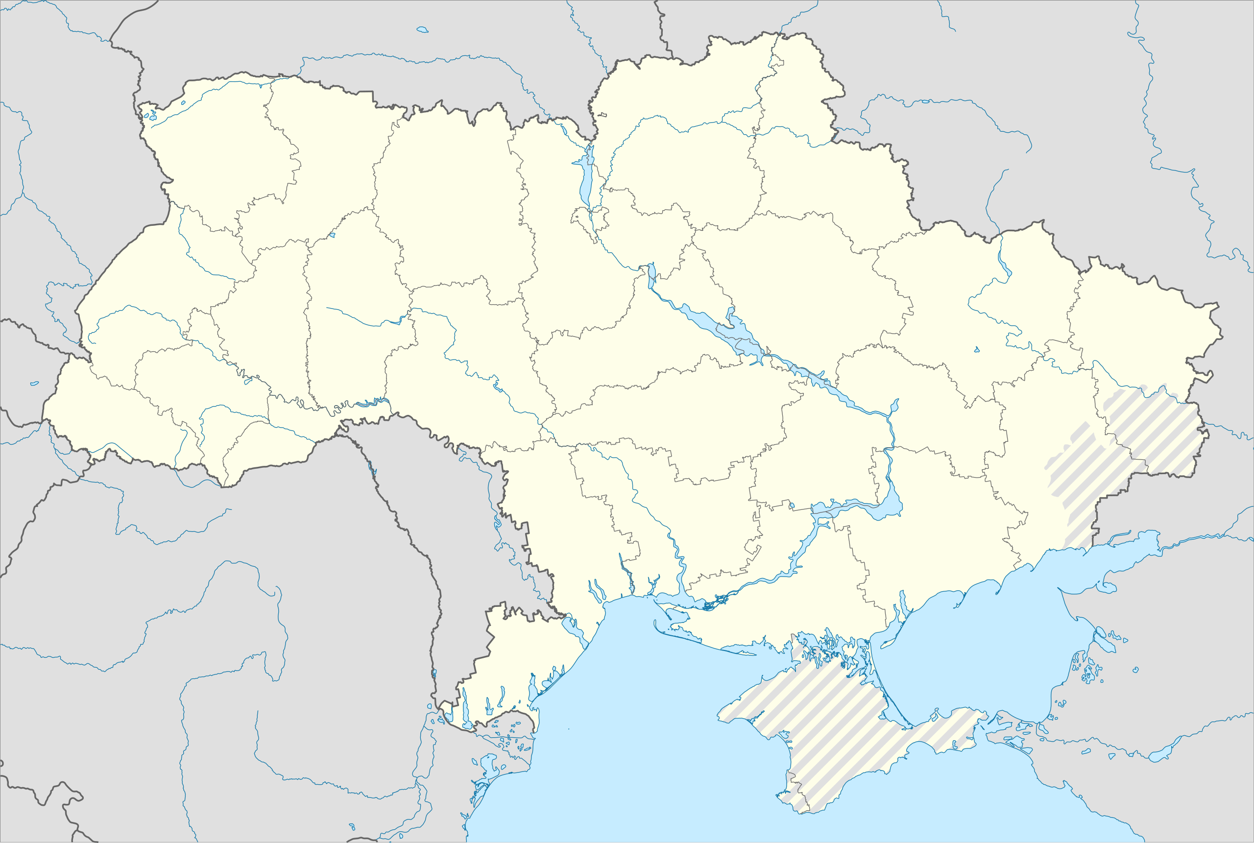
English: Location map of Ukraine under Russian occupation.
Українська: Карта України з зонами російської окупації. |
| Siku | |
| Ukaboni |
Own work using: Ukraine adm location map improved.svg, according to
|
| Mlembi | Yakiv Gluck |
| Other versions |
|
| SVG genesis | This map was created with Adobe Illustrator. |


Chilolezo
I, the copyright holder of this work, hereby publish it under the following license:
This file is licensed under the Creative Commons Attribution-Share Alike 4.0 International license.
- Ndimwe ŵakuzomelezgeka:
- kugaŵa – kuti mutandazge, kugaŵa na kusintha ntchito
- kusazga – kusintha chito iyi
- Pa malango ghakulondezga agha:
- Viyambilo vya kuchita – Mukwenela kupeleka malumbo ghawemi, kupeleka linki yakutyonda ku chilolezo, kweneso yowoyaniso pala vinyake vyasintha. Mukwenela kuchita nthena mwakwenelela, kwambula kujikhalila khonde.
- mwa kugaŵana – Pala mwasazga panji mwasintha chinthu, mukwenela kuchitandazga
Mbili ya chinthu
Dofyani pa siku/nyengo kuti muone umo vikaonekela pa nyengo iyo.
| Siku/Nyengo | Kachithuzi | Vipimo | Mgwiliski | Ganizo | |
|---|---|---|---|---|---|
| sono | 06:53, 19 Juni 2023 | | 3,780 × 2,540 (1.8 MB) | Physeters | Reverted to version as of 02:11, 12 May 2023 (UTC) revert removed my detail improvements in the Dnieper delta and is no longer accurate |
| 21:48, 18 Juni 2023 |  | 3,780 × 2,540 (1.54 MB) | Yeagvr | Reverted to version as of 17:23, 3 October 2022 (UTC) | |
| 02:11, 12 Meyi 2023 |  | 3,780 × 2,540 (1.8 MB) | Physeters | add improved tracing of the Dnieper Delta | |
| 01:30, 4 Okutobala 2022 |  | 3,780 × 2,540 (1.36 MB) | Tol | Reverted to version as of 17:17, 3 March 2018 (UTC): this substantially changes a file that was not expected to be updated, this file is intentionally different from File:Ukraine under russian occupation.svg | |
| 17:23, 3 Okutobala 2022 |  | 3,780 × 2,540 (1.54 MB) | Janitoalevic | Updated. | |
| 17:17, 3 Malichi 2018 |  | 3,780 × 2,540 (1.36 MB) | Yakiv Gluck | improved using new adm loc map | |
| 01:36, 27 Janyuwale 2018 |  | 1,546 × 1,038 (457 KB) | Yakiv Gluck | {{Information |Description ={{en|Location map of Ukraine under russian occupation.}} {{uk|Карта України з зонами російської окупації.}} |Source =own work, using [[:F... |
Magwiliskilo ntchito
The following 2 pages use this file:
Umo chinthu chagwiliskikila ntchito
Ma wiki ghanyake agho ghakugwiliska ichi:
- Magwiliskilo pa bcl.wikipedia.org
- Magwiliskilo pa bn.wikipedia.org
- Magwiliskilo pa en.wikipedia.org
- Chernobyl
- Geography of Ukraine
- Poltava
- Kerch
- Sevastopol
- Tarashcha
- Yalta
- Nestor Makhno
- Sverdlovsk, Ukraine
- Chernivtsi
- Kaniv
- Halych
- Pripyat
- Lutsk
- Drohobych
- Kovel
- Ivano-Frankivsk
- Kalush, Ukraine
- Volodymyr (city)
- Kortelisy
- Starobilsk
- Uzhhorod
- Chernihiv
- Sumy
- Staryi Ostropil
- Kyiv
- Kosivka, Odesa Oblast
- Kosiv
- Shpola
- Mukachevo
- Simferopol
- Irpin
- Khmelnytskyi
- Fastiv
- Boltysh crater
Wonani magwiliskilo ghanandi ghapa charu gha chinthu ichi.