
File:USA Texas location map.svg

Size of this PNG preview of this SVG file: 606 × 600 pixels. Mu misani inyake: 243 × 240 pixels | 485 × 480 pixels | 776 × 768 pixels | 1,035 × 1,024 pixels | 2,070 × 2,048 pixels | 1,500 × 1,484 pixels.
Chinthu cha kwenekuko (SVG file, nominally 1,500 × 1,484 pixels, file size: 695 KB)
Mwakudumula
| Malongosolelo |
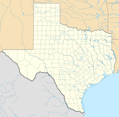
Quadratische Plattkarte, N-S-Streckung 120 %. Geographische Begrenzung der Karte:
Equirectangular projection, N/S stretching 120 %. Geographic limits of the map:
|
| Siku | |
| Ukaboni | Chinthu chane |
| Mlembi | Alexrk |
| Other versions |
Derivative works of this file: |

|
This map has been made or improved in the German Kartenwerkstatt (Map Lab). You can propose maps to improve as well.
|
Chilolezo
I, the copyright holder of this work, hereby publish it under the following licenses:

|
Chilolezo ntchakupelekeka pakupanga copy, kutandazga panj kusintha na malango gha GNU Free Documentation License, Version 1.2 or any later version published by the Free Software Foundation; with no Invariant Sections, no Front-Cover Texts, and no Back-Cover Texts. A copy of the license is included in the section entitled GNU Free Documentation License. |
This file is licensed under the Creative Commons Attribution 3.0 Unported license.
- Ndimwe ŵakuzomelezgeka:
- kugaŵa – kuti mutandazge, kugaŵa na kusintha ntchito
- kusazga – kusintha chito iyi
- Pa malango ghakulondezga agha:
- Viyambilo vya kuchita – Mukwenela kupeleka malumbo ghawemi, kupeleka linki yakutyonda ku chilolezo, kweneso yowoyaniso pala vinyake vyasintha. Mukwenela kuchita nthena mwakwenelela, kwambula kujikhalila khonde.
You may select the license of your choice.
Mbili ya chinthu
Dofyani pa siku/nyengo kuti muone umo vikaonekela pa nyengo iyo.
| Siku/Nyengo | Kachithuzi | Vipimo | Mgwiliski | Ganizo | |
|---|---|---|---|---|---|
| sono | 20:30, 17 Juni 2009 | | 1,500 × 1,484 (695 KB) | Alexrk2 | enh |
| 13:05, 7 Juni 2009 |  | 1,500 × 1,484 (558 KB) | Alexrk | water bodies 1:10mio | |
| 21:43, 6 Juni 2009 |  | 1,500 × 1,484 (850 KB) | Alexrk | GeneralizationDistance = 2px | |
| 17:41, 6 Juni 2009 |  | 1,500 × 1,485 (1.48 MB) | Alexrk | == Beschreibung == {{Information |Description= {{de|Positionskarte von Texas, USA}} Quadratische Plattkarte, N-S-Streckung 120 %. Geographische Begrenzung der Karte: * N: 36.8° N * S: 25.5° N * W: 106.9° W * O: 93.2° W {{en|L |
Magwiliskilo ntchito
The following 3 pages use this file:
Umo chinthu chagwiliskikila ntchito
Ma wiki ghanyake agho ghakugwiliska ichi:
- Magwiliskilo pa af.wikipedia.org
- Magwiliskilo pa als.wikipedia.org
- Magwiliskilo pa an.wikipedia.org
- Magwiliskilo pa ar.wikipedia.org
- Magwiliskilo pa ast.wikipedia.org
- Magwiliskilo pa azb.wikipedia.org
- سایپرس، تکزاس
- ونکورت، تکزاس
- شابلون:Location map Texas
- لوپ، تکزاس
- اوریسن، تکزاس
- لاس پالماس ۲، تکزاس
- قلیدن، تکزاس
- آنیون کریک، آستین، تکزاس
- کوپلند، تکزاس
- ساوانا، تکزاس
- آرویو قاردنز-لاتینا رنچ، تکزاس
- تییرا بونتیا، تکزاس
- لیک مردیت استیتس، تکزاس
- منچاکا، تکزاس
- باوزل اند الیس، تکزاس
- وست پیرسال، تکزاس
- بونانزا هیلز، تکزاس
- تاندربیرد بی، تکزاس
- لاس پالماس، تکزاس
- آریو آلتو، تکزاس
- پینت کریت، تکزاس
- مونتاژ، تکزاس
- پالوما کریک ساوت، تکزاس
- کولورادو ایکرز، تکزاس
- امارقوسا، تکزاس
- لینکلن، تکزاس
- نورتکلیف، تکزاس
Wonani magwiliskilo ghanandi ghapa charu gha chinthu ichi.