
File:USA New Mexico location map.svg

Size of this PNG preview of this SVG file: 533 × 600 pixels. Mu misani inyake: 213 × 240 pixels | 426 × 480 pixels | 682 × 768 pixels | 910 × 1,024 pixels | 1,820 × 2,048 pixels | 1,245 × 1,401 pixels.
Chinthu cha kwenekuko (SVG file, nominally 1,245 × 1,401 pixels, file size: 231 KB)
What time is the 4 get to Walmart.
Mwakudumula
| Malongosolelo |
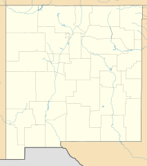
Quadratische Plattkarte, N-S-Streckung 120.0 %. Geographische Begrenzung der Karte:
Equirectangular projection, N/S stretching 120.0 %. Geographic limits of the map:
Phép chiếu ngang, N / S kéo dài 120,0%. Giới hạn địa lý của bản đồ:
|
| Siku | |
| Ukaboni | Chinthu chane |
| Mlembi | Alexrk2 |
| Other versions |
Derivative works of this file: NM GRT rates.svg Derivative works of this file: |

|
This map has been made or improved in the German Kartenwerkstatt (Map Lab). You can propose maps to improve as well.
|
Chilolezo
I, the copyright holder of this work, hereby publish it under the following licenses:

|
Chilolezo ntchakupelekeka pakupanga copy, kutandazga panj kusintha na malango gha GNU Free Documentation License, Version 1.2 or any later version published by the Free Software Foundation; with no Invariant Sections, no Front-Cover Texts, and no Back-Cover Texts. A copy of the license is included in the section entitled GNU Free Documentation License. |
This file is licensed under the Creative Commons Attribution 3.0 Unported license.
- Ndimwe ŵakuzomelezgeka:
- kugaŵa – kuti mutandazge, kugaŵa na kusintha ntchito
- kusazga – kusintha chito iyi
- Pa malango ghakulondezga agha:
- Viyambilo vya kuchita – Mukwenela kupeleka malumbo ghawemi, kupeleka linki yakutyonda ku chilolezo, kweneso yowoyaniso pala vinyake vyasintha. Mukwenela kuchita nthena mwakwenelela, kwambula kujikhalila khonde.
You may select the license of your choice.
Mbili ya chinthu
Dofyani pa siku/nyengo kuti muone umo vikaonekela pa nyengo iyo.
| Siku/Nyengo | Kachithuzi | Vipimo | Mgwiliski | Ganizo | |
|---|---|---|---|---|---|
| sono | 15:48, 2 Okutobala 2009 | | 1,245 × 1,401 (231 KB) | Alexrk2 | == Beschreibung == {{Information |Description= {{de|Positionskarte von New Mexico, USA}} Quadratische Plattkarte, N-S-Streckung 120.0 %. Geographische Begrenzung der Karte: * N: 37.2° N * S: 31.1° N * W: 109.3° W * O: 102 |
Magwiliskilo ntchito
The following 3 pages use this file:
Umo chinthu chagwiliskikila ntchito
Ma wiki ghanyake agho ghakugwiliska ichi:
- Magwiliskilo pa an.wikipedia.org
- Magwiliskilo pa ar.wikipedia.org
- Magwiliskilo pa azb.wikipedia.org
- البوکرکی
- سانتافه، نیومکزیکو
- تائوس پوئبلو
- پاستورا، نیومکزیکو
- اوت پارک، نیو مکزیکو
- لاس ماراویلاس، نیومکزیکو
- اسپنسرویل، نیومکزیکو
- ناپی هدکوارترز، نیومکزیکو
- پردایس هیلز، نیومکزیکو
- ساندیا هایتس، نیومکزیکو
- مککارتیز ویلج، نیو مکزیکو
- هپی ولی، نیومکزیکو
- هاچیتا، نیومکزیکو
- اسکاندیدا، نیومکزیکو
- هومستد، نیومکزیکو
- ونچورا، نیومکزیکو
- ال سرو میشن، نیومکزیکو
- آنیماس، نیومکزیکو
- ویندمیل، نیومکزیکو
- سانشاین، نیومکزیکو
- نورت لایت پلنت، نیومکزیکو
- کوردووا، نیومکزیکو
- دتیل، نیومکزیکو
- روزدیل، نیومکزیکو
- کوبری، نیومکزیکو
- رادی، نیومکزیکو
- پلایس، نیومکزیکو
- پیک پلیس، نیومکزیکو
- مورنینقساید، نیومکزیکو
- دورن، نیومکزیکو
- کوئیمادو، نیومکزیکو
- لمیتار، نیومکزیکو
- لیک رابرتس هایتس، نیومکزیکو
- کینقستن، نیومکزیکو
- سیتی آف د سان، نیومکزیکو
- لور فریسکو، نیومکزیکو
- نورت هرلی، نیومکزیکو
- ال سرو، نیومکزیکو
- ساندیا نولز، نیومکزیکو
- کوبرو، نیومکزیکو
- ناواهو دم، نیومکزیکو
Wonani magwiliskilo ghanandi ghapa charu gha chinthu ichi.