
File:USA California Southern location map.svg

Size of this PNG preview of this SVG file: 685 × 387 pixels. Mu misani inyake: 320 × 181 pixels | 640 × 362 pixels | 1,024 × 579 pixels | 1,280 × 723 pixels | 2,560 × 1,446 pixels.
Chinthu cha kwenekuko (SVG file, nominally 685 × 387 pixels, file size: 430 KB)
Mwakudumula
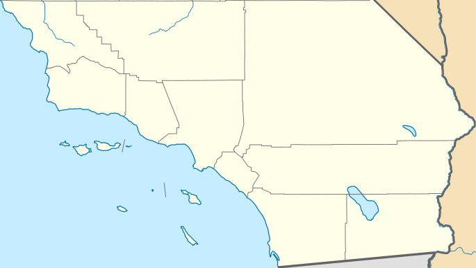
| Malongosolelo | Quadratische Plattkarte, N-S-Streckung 125 %. Geographische Begrenzung der Karte: * N: 35.7911111° N * S: 32.5342232° N * W: 121.342031° W * E: 114.131282° W Equirectangular projection, N/S stretching 125 %. Geographic limits of the map: * N: 35.7911111° N * S: 32.5342232° N * W: 121.342031° W * E: 114.131282° W | ||
| Siku | |||
| Ukaboni | |||
| Mlembi |
|
||
| SVG genesis | This locator map was created with Inkscape by NordNordWest.
|
Chilolezo
I, the copyright holder of this work, hereby publish it under the following licenses:
This file is licensed under the Creative Commons Attribution 3.0 Unported license.
- Ndimwe ŵakuzomelezgeka:
- kugaŵa – kuti mutandazge, kugaŵa na kusintha ntchito
- kusazga – kusintha chito iyi
- Pa malango ghakulondezga agha:
- Viyambilo vya kuchita – Mukwenela kupeleka malumbo ghawemi, kupeleka linki yakutyonda ku chilolezo, kweneso yowoyaniso pala vinyake vyasintha. Mukwenela kuchita nthena mwakwenelela, kwambula kujikhalila khonde.

|
Chilolezo ntchakupelekeka pakupanga copy, kutandazga panj kusintha na malango gha GNU Free Documentation License, Version 1.2 or any later version published by the Free Software Foundation; with no Invariant Sections, no Front-Cover Texts, and no Back-Cover Texts. A copy of the license is included in the section entitled GNU Free Documentation License. |
You may select the license of your choice.
Original upload log
This image is a derivative work of the following images:
- USA California location map.svg licensed with Cc-by-3.0, GFDL
- 2009-06-05T19:17:46Z NordNordWest 1022x1171 (491838 Bytes) more detailed
- 2009-03-12T21:50:35Z NordNordWest 1020x1169 (394722 Bytes) {{Information |Description= {{de|Positionskarte von [[:de:Kalifornien|Kalifornien]], [[:de:USA|USA]]}} Quadratische Plattkarte, N-S-Streckung 125 %. Geographische Begrenzung der Karte: * N: 42.2° N * S: 32.3° N * W: 124.7°
Uploaded with derivativeFX
Mbili ya chinthu
Dofyani pa siku/nyengo kuti muone umo vikaonekela pa nyengo iyo.
| Siku/Nyengo | Kachithuzi | Vipimo | Mgwiliski | Ganizo | |
|---|---|---|---|---|---|
| sono | 23:31, 25 Novembala 2011 | | 685 × 387 (430 KB) | Banaticus | == {{int:filedesc}} == {{Information |Description={{de|Positionskarte von Kalifornien, USA}} Quadratische Plattkarte, N-S-Streckung 125 %. Geographische Begrenzung der Karte: * N: 35.7911111° N * S: 32.5342232° N * W: 121 |
Magwiliskilo ntchito
The following 2 pages use this file:
Umo chinthu chagwiliskikila ntchito
Ma wiki ghanyake agho ghakugwiliska ichi:
- Magwiliskilo pa ar.wikipedia.org
- Magwiliskilo pa azb.wikipedia.org
- Magwiliskilo pa ceb.wikipedia.org
- Magwiliskilo pa ckb.wikipedia.org
- Magwiliskilo pa en.wikipedia.org
- L. Ron Hubbard
- El Centro, California
- Holtville, California
- Salton City, California
- Boron, California
- Frazier Park, California
- Inyokern, California
- Lake of the Woods, California
- Lebec, California
- Ridgecrest, California
- Bell Gardens, California
- Inglewood, California
- Littlerock, California
- South Gate, California
- Willowbrook, California
- Laguna Woods, California
- Newport Beach, California
- Desert Hot Springs, California
- Idyllwild–Pine Cove, California
- Indio, California
- Palm Desert, California
- Adelanto, California
- Apple Valley, California
- Barstow, California
- Lake Arrowhead, California
- Montclair, California
- San Bernardino, California
- Yucaipa, California
- Julian, California
- National City, California
- Poway, California
- Rancho Santa Fe, California
- Winter Gardens, California
- Cambria, California
Wonani magwiliskilo ghanandi ghapa charu gha chinthu ichi.