
File:South Africa Gauteng location map.svg

Size of this PNG preview of this SVG file: 608 × 599 pixels. Mu misani inyake: 243 × 240 pixels | 487 × 480 pixels | 779 × 768 pixels | 1,039 × 1,024 pixels | 2,077 × 2,048 pixels | 1,061 × 1,046 pixels.
Chinthu cha kwenekuko (SVG file, nominally 1,061 × 1,046 pixels, file size: 97 KB)
Mwakudumula
| Malongosolelo |
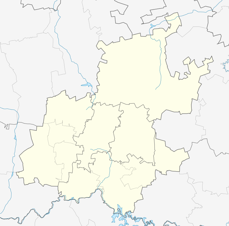
English: Location map of Gauteng
Equirectangular projection, N/S stretching 111%. Geographic limits of the map:
|
| Siku | |
| Ukaboni |
|
| Mlembi | Htonl |
| Chilolezo (Kugwiliskaso ntchito ichi) |
I, the copyright holder of this work, hereby publish it under the following license: Chinthu ichi ntchakuzomelezgeka na Creative Commons Attribution-Share Alike 3.0 Unported license.
|
| Other versions | File:South Africa Gauteng relief location map.svg, File:Blank map of Gauteng (2011).svg |
.svg)
Mbili ya chinthu
Dofyani pa siku/nyengo kuti muone umo vikaonekela pa nyengo iyo.
| Siku/Nyengo | Kachithuzi | Vipimo | Mgwiliski | Ganizo | |
|---|---|---|---|---|---|
| sono | 20:22, 5 Janyuwale 2013 | | 1,061 × 1,046 (97 KB) | Htonl | == {{int:filedesc}} == {{Information |Description ={{en|Location map of en:Gauteng Equirectangular projection, N/S stretching 111%. Geographic limits of the map: * N: 25° S * S: 27° S * W: 27° E * E: 29.25° E}} |Source = * Boundari... |
Magwiliskilo ntchito
More than 100 pages use this file. The following list shows the first 100 pages that use this file only. A full list is available.
- Airdlin
- Alberton, Gauteng
- Albertskroon
- Albertville, Gauteng
- Aldara Park
- Allen Grove, Kempton Park
- Amalgam
- Auckland Park
- Bapsfontein, Gauteng
- Barbeque Downs
- Barbeque Downs, Johannesburg
- Bedfordview, Gauteng
- Benoni, Gauteng
- Berario
- Beverley
- Beverley, Johannesburg
- Beverley Gardens
- Birchleigh, Kempton Park
- Blackheath
- Blairgowrie
- Bloubosrand, Johannesburg
- Blue Hills, Johannesburg
- Boksburg, Gauteng
- Bonaero Park, Kempton Park
- Bordeaux, Gauteng
- Bosmont
- Brakpan, Gauteng
- Brixton
- Broadacres, Johannesburg
- Bryanbrink
- Bryanston West
- Buccleuch, Johannesburg
- Carlswald, Johannesburg
- Chartwell, Johannesburg
- Clynton
- Country Life Park, Gauteng
- Country View, Johannesburg
- Cowdray Park
- Craighall
- Craighall Park
- Cramerview
- Cresslawn, Kempton Park
- Cresta
- Crown, Gauteng
- Dainfern, Johannesburg
- Daniel Brink Park, Gauteng
- Darrenwood
- Daveyton, Gauteng
- Dawn Park, Gauteng
- Diepsloot, Johannesburg
- Duduza, Gauteng
- Dunkeld
- Dunkeld West
- Ebony Park, Johannesburg
- Edenvale, Gauteng
- Edleen, Kempton Park
- Elsburg, Gauteng
- Emmarentia
- Erand, Johannesburg
- Esther Park, Kempton Park
- Etwatwa, Gauteng
- Ferndale
- Florida Glen
- Fontainebleau
- Germiston, Gauteng
- Hurlingham Gardens
- Hyde Park, Gauteng
- Isando, Gauteng
- Ivory Park, Johannesburg
- Katlehong, Gauteng
- Kempton Park, Gauteng
- Kensington B
- KwaThema, Gauteng
- Linden
- Lyme Park
- Malanshof
- Melville
- Mill Hill
- Millgate Farm, Johannesburg
- New Brighton, Johannesburg
- Nigel, Gauteng
- Norkem Park, Kempton Park
- Parkhurst
- Parkmore
- Parkview, Gauteng
- Paulshof
- Phiri la Lone
- Praegville, Gauteng
- President Ridge
- Primrose, Gauteng
- Randburg
- Randpark
- Reiger Park, Gauteng
- Springs, Gauteng
- Tembisa, Gauteng
- Thokoza, Gauteng
- Tsakane, Gauteng
- Van Riebeeck Park, Kempton Park
- Vandia Grove
- Vosloorus, Gauteng
View more links to this file.
Umo chinthu chagwiliskikila ntchito
Ma wiki ghanyake agho ghakugwiliska ichi:
- Magwiliskilo pa af.wikipedia.org
- Johannesburg
- Pretoria
- Heidelberg, Gauteng
- Suikerbosrand-natuurreservaat
- Roodepoort
- Sharpeville
- Centurion
- Cullinan
- Krugersdorp
- Springs
- Brakpan
- Kliptown
- Alberton
- Germiston
- Boksburg
- Benoni
- Carletonville
- Petervale, Johannesburg
- Marabastad
- Waterkloof
- Groenkloof
- Arcadia, Pretoria
- Vereeniging
- Kemptonpark
- Edenvale
- Nigel
- Meyerton
- Vanderbijlpark
- Elarduspark
- Soweto
- Wonderboomlughawe
- Irene
- Bapsfontein
- Bronkhorstspruit
- Randfontein
- Randburg
- Ennerdale
- Magaliesburg
- Sophiatown
- Rosettenville
- Kleinfontein
- Linden
- Woodmead, Johannesburg
- Mabopane
- Rosebank, Johannesburg
- Atteridgeville
- Capital Park
- Hammanskraal
- Westonaria
- Rayton
Wonani magwiliskilo ghanandi ghapa charu gha chinthu ichi.