
File:Relief Map of Poland.svg

Size of this PNG preview of this SVG file: 617 × 600 pixels. Mu misani inyake: 247 × 240 pixels | 494 × 480 pixels | 790 × 768 pixels | 1,053 × 1,024 pixels | 2,107 × 2,048 pixels | 861 × 837 pixels.
Chinthu cha kwenekuko (SVG file, nominally 861 × 837 pixels, file size: 4 MB)
Mwakudumula
| Malongosolelo |
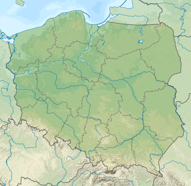
Deutsch: Positionskarte von Polen
Quadratische Plattkarte, N-S-Streckung 160 %. Geographische Begrenzung der Karte:
English: Location map of Poland
Equirectangular projection, N/S stretching 160 %. Geographic limits of the map:
|
| Siku | |
| Ukaboni |
Chinthu chane This vector image includes elements that have been taken or adapted from this file: This vector image includes elements that have been taken or adapted from this file: |
| Mlembi |
TUBS |
| Other versions |
|
| SVG genesis | This map was created with Adobe Illustrator by TUBS. |


Chilolezo
I, the copyright holder of this work, hereby publish it under the following license:
Chinthu ichi ntchakuzomelezgeka na Creative Commons Attribution-Share Alike 3.0 Unported license.
- Ndimwe ŵakuzomelezgeka:
- kugaŵa – kuti mutandazge, kugaŵa na kusintha ntchito
- kusazga – kusintha chito iyi
- Pa malango ghakulondezga agha:
- Viyambilo vya kuchita – Mukwenela kupeleka malumbo ghawemi, kupeleka linki yakutyonda ku chilolezo, kweneso yowoyaniso pala vinyake vyasintha. Mukwenela kuchita nthena mwakwenelela, kwambula kujikhalila khonde.
- mwa kugaŵana – Pala mwasazga panji mwasintha chinthu, mukwenela kuchitandazga

|
I'd greatly appreciate, that you attribute this media file to Wikimedia Commons, if used outside Wikipedia or Commons. For use in publications such as books, newspapers, blogs, websites, please insert here the following line:
|
Mbili ya chinthu
Dofyani pa siku/nyengo kuti muone umo vikaonekela pa nyengo iyo.
| Siku/Nyengo | Kachithuzi | Vipimo | Mgwiliski | Ganizo | |
|---|---|---|---|---|---|
| sono | 23:20, 30 Novembala 2021 | | 861 × 837 (4 MB) | Puck04 | fixed SVG code (was "W3C-invalid") + cleanup using text editor; contains raster graphics however |
| 20:54, 3 Febuluwale 2021 |  | 861 × 837 (4.18 MB) | SANtosito | Vectorized topo | |
| 21:52, 30 Novembala 2011 |  | 861 × 837 (4.87 MB) | TUBS | == {{int:filedesc}} == {{Information |Description={{en|Relief map of Poland}} Equirectangular projection, N/S stretching 160 %. Geographic limits of the map: * N: 55.2° N * S: 48.7° N * W: 13.8° E * E: 24.5° E |Source={{own}}{{Adobe Il |
Magwiliskilo ntchito
The following 5 pages use this file:
Umo chinthu chagwiliskikila ntchito
Ma wiki ghanyake agho ghakugwiliska ichi:
- Magwiliskilo pa ab.wikipedia.org
- Magwiliskilo pa als.wikipedia.org
- Magwiliskilo pa ar.wikipedia.org
- Magwiliskilo pa av.wikipedia.org
- Magwiliskilo pa azb.wikipedia.org
- Magwiliskilo pa az.wikipedia.org
- Şablon:Yer xəritəsi Polşa
- Əyri meşə
- Slovinski Milli Parkı
- Dzivna boğazı
- Yamno gölü
- Baltik dili
- Şablon:Dil (coğrafiya)
- Şablon:Dil (coğrafiya)/doc
- Xel dili
- Blendovka səhrası
- Morskie Oko gölü
- Belka-Snejna mağarası
- Karsibur adası
- Ambarlar adası
- Qrabovski adası
- Haliç dağı
- Jives gölü
- Rozeve burnu
- Lısa-Gora dağı
- Avqustovskaya puşa
- Tuxolskie borı
- Rastoçe
- Rominten meşəsi
- Solina gölü
- Qartal Yuvası təbiət parkı
- Çarne gölü
- Pienini dağları
- Magwiliskilo pa ban.wikipedia.org
- Taman Nasional Tatra, Polandia
- Taman Nasional Bieszczady
- Lis taman nasional ring Polandia
- Taman Nasional Wielkopolska
- Taman Nasional Pieniny (Polandia)
- Taman Nasional Gorce
- Taman Nasional Babia Góra
- Taman Nasional Białowieża
- Taman Nasional Biebrza
- Taman Nasional Kampinos
- Taman Nasional Narew
- Taman Nasional Wigry
- Taman Nasional Magura
- Taman Nasional Roztocze
- Taman Nasional Polesie
Wonani magwiliskilo ghanandi ghapa charu gha chinthu ichi.