
File:Plateau communes.png
Saizi ya chakuona ichi: 776 × 600 pixels. Mu misani inyake: 311 × 240 pixels | 621 × 480 pixels | 994 × 768 pixels | 1,056 × 816 pixels.
Chinthu cha kwenekuko (1,056 × 816 pixels, file size: 27 KB, MIME type: image/png)
Mwakudumula
| Malongosolelo |
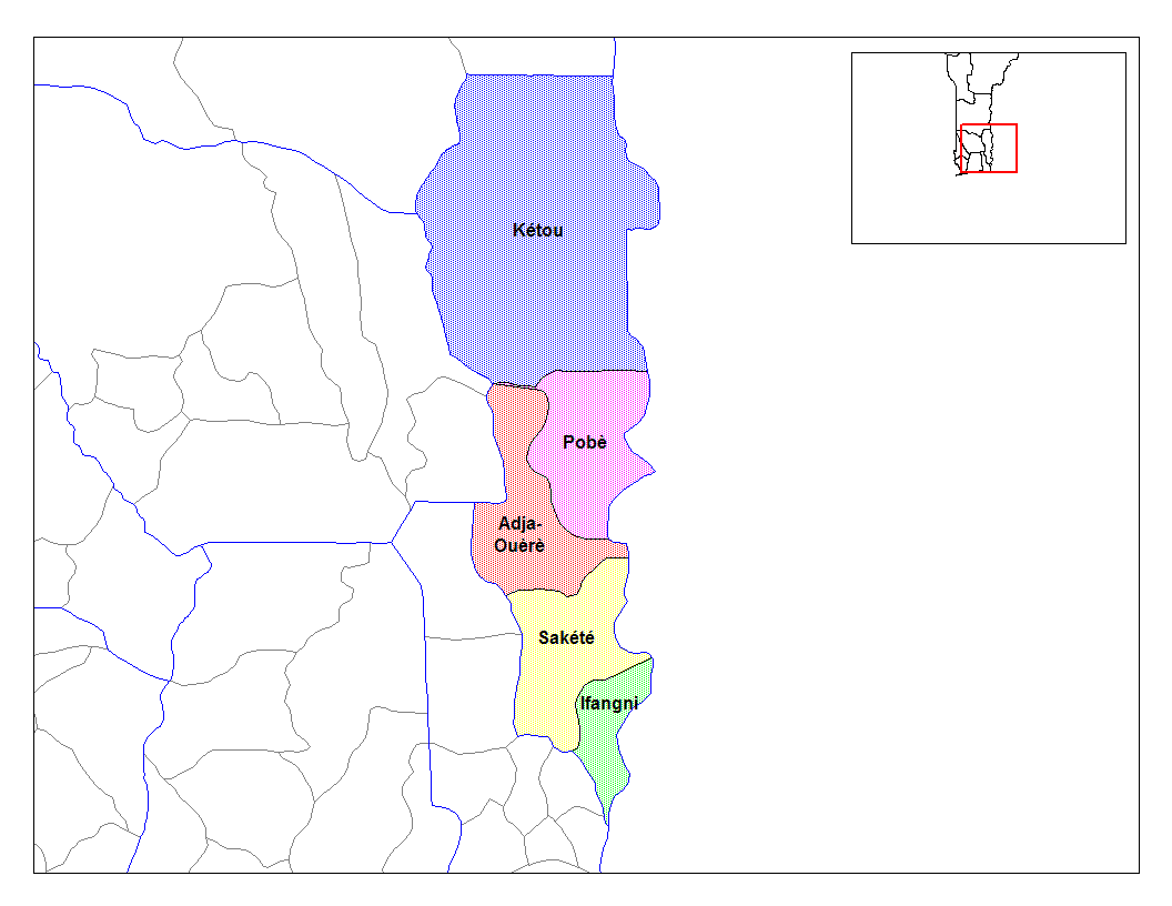
English: Map of the communes of the department of Plateau, Benin. Created by Rarelibra for public domain use. Created using MapInfo Professional v7.5 and various mapping resources. |
| Siku | 5 Malichi 2006 (original upload date) |
| Ukaboni | Transferred from en.wikipedia to Commons. |
| Mlembi | Rarelibra at English Wikipediya |
Chilolezo
| This work has been released into the public domain by its author, Rarelibra at English Wikipediya. This applies worldwide. In some countries this may not be legally possible; if so: Rarelibra grants anyone the right to use this work for any purpose, without any conditions, unless such conditions are required by law. |
Original upload log
The original description page was here. All following user names refer to en.wikipedia.
- 2006-03-05 02:58 Rarelibra 1056×816× (27153 bytes) Map of the communes of the department of Plateau, Benin. Created by Rarelibra for public domain use. Created using MapInfo Professional v7.5 and various mapping resources.
Mbili ya chinthu
Dofyani pa siku/nyengo kuti muone umo vikaonekela pa nyengo iyo.
| Siku/Nyengo | Kachithuzi | Vipimo | Mgwiliski | Ganizo | |
|---|---|---|---|---|---|
| sono | 10:37, 28 Epulelo 2010 | | 1,056 × 816 (27 KB) | Deadstar | larger size file from en: wiki |
| 15:16, 17 Febuluwale 2007 |  | 776 × 600 (112 KB) | Reyos | from http://en.wikipedia.org/wiki/Image:Plateau_communes.png |
Magwiliskilo ntchito
The following page uses this file:
Umo chinthu chagwiliskikila ntchito
Ma wiki ghanyake agho ghakugwiliska ichi:
- Magwiliskilo pa ar.wikipedia.org
- Magwiliskilo pa ca.wikipedia.org
- Magwiliskilo pa ceb.wikipedia.org
- Magwiliskilo pa de.wikipedia.org
- Magwiliskilo pa en.wikipedia.org
- Magwiliskilo pa eo.wikipedia.org
- Magwiliskilo pa es.wikipedia.org
- Magwiliskilo pa fi.wikipedia.org
- Magwiliskilo pa frr.wikipedia.org
- Magwiliskilo pa fr.wikipedia.org
- Magwiliskilo pa ha.wikipedia.org
- Magwiliskilo pa hu.wikipedia.org
- Magwiliskilo pa id.wikipedia.org
- Magwiliskilo pa ig.wikipedia.org
- Magwiliskilo pa it.wikipedia.org
- Magwiliskilo pa ja.wikipedia.org
- Magwiliskilo pa lt.wikipedia.org
- Magwiliskilo pa nl.wikipedia.org
- Magwiliskilo pa pt.wikipedia.org
- Magwiliskilo pa ro.wikipedia.org
- Magwiliskilo pa sv.wikipedia.org
- Magwiliskilo pa sw.wikipedia.org
- Magwiliskilo pa tr.wikipedia.org
- Magwiliskilo pa ts.wikipedia.org
Wonani magwiliskilo ghanandi ghapa charu gha chinthu ichi.