
File:Papua New Guinea (orthographic projection).svg

Size of this PNG preview of this SVG file: 541 × 541 pixels. Mu misani inyake: 240 × 240 pixels | 480 × 480 pixels | 768 × 768 pixels | 1,024 × 1,024 pixels | 2,048 × 2,048 pixels.
Chinthu cha kwenekuko (SVG file, nominally 541 × 541 pixels, file size: 260 KB)
Mwakudumula
| Malongosolelo |
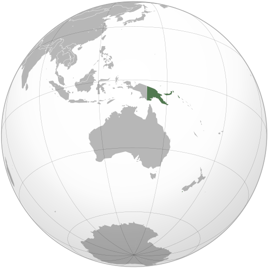
English: Location of Papua New Guinea on the globe. |
||
| Siku |
.svg)
|
||
| Ukaboni | Chinthu chane | ||
| Mlembi | Zuanzuanfuwa | ||
| SVG genesis |
.svg)
.svg)
.svg)
.svg)
.svg)
.svg)
.svg)
.svg)
.svg)
.svg)
.svg)
.svg)
.svg)
.svg)
.svg)
.svg)
.svg)
.svg)
.svg)
.svg)
.svg)
.svg)
.svg)
.svg)
.svg)
.svg)
.svg)
.svg)
.svg)
.svg)
.svg)
.svg)
.svg)
.svg)
.svg)
.svg)
.svg)
.svg)
.svg)
.svg)
.svg)
.svg)
.svg)
.svg)
.svg)
.svg)
.svg)
.svg)
.svg)
.svg)
.svg)
.svg)
.svg)
.svg)
.svg)
.svg)
.svg)
.svg)
.svg)
.svg)
.svg)
.svg)
.svg)
.svg)
.svg)
.svg)
.svg)
.svg)
.svg)
.svg)
.svg)
.svg)
.svg)

.svg)

.svg)

.svg)
.svg)
.svg)
.svg)
.svg)
.svg)
.svg)


.svg)
.svg)
.svg)
.svg)
.svg)
.svg)
.svg)

.svg)
.svg)
.svg)
.svg)
.svg)
.svg)
.svg)
.svg)
.svg)
.svg)

.svg)
.svg)
.svg)
.svg)
.svg)
.svg)
.svg)
_without_national_boundaries.svg)
.svg)
.svg)
.svg)
.svg)
.svg)
.svg)

.svg)
.svg)
.png)
.svg)
.svg)
.svg)
.svg)

.svg)
.svg)
.svg)
.svg)
.svg)
.svg)
.svg)
.svg)
.svg)
.svg)
.svg)

.svg)
.svg)
.svg)
.svg)
.svg)
.svg)
.svg)
.svg)
.svg)

.svg)
.svg)

.svg)
.svg)
.svg)
.svg)
.svg)
.svg)
.svg)
.svg)
.svg)
.svg)
.svg)
.svg)
.svg)
.svg)
.svg)
.svg)
.svg)
.svg)
.svg)
.svg)
.svg)
.svg)
.svg)
.svg)
.svg)
.svg)
.svg)
_-_Crimea_disputed.svg)
.svg)
.svg)
.svg)
.svg)
.svg)
.svg)
.svg)
.svg)
.svg)
.svg)
.svg)
_political.svg)
.svg)
.svg)
.svg)
.svg)
_-_Crimea_disputed_-_no_borders.svg)
.svg)
.svg)
.svg)
.svg)
.svg)
.svg)
.svg)
.svg)
.svg)
.svg)
.svg)

.svg)
.svg)
.svg)

.png)
.svg)
.svg)
.svg)
.svg)
.svg)
.svg)
.svg)
.svg)
.svg)
.svg)
.svg)
.svg)
.svg)
.svg)
.svg)
.svg)
.svg)
.svg)
.svg)
.svg)
.svg)
.svg)
.svg)
.svg)
.svg)
.svg)
.svg)
.svg)
.svg)
.svg)
.svg)
.svg)
.svg)
.svg)
.png)
.svg)
.svg)
.svg)
_(orthographic_projection).png)
.svg)
.svg)
.svg)
Chilolezo
I, the copyright holder of this work, hereby publish it under the following licenses:

|
Chilolezo ntchakupelekeka pakupanga copy, kutandazga panj kusintha na malango gha GNU Free Documentation License, Version 1.2 or any later version published by the Free Software Foundation; with no Invariant Sections, no Front-Cover Texts, and no Back-Cover Texts. A copy of the license is included in the section entitled GNU Free Documentation License. |
This file is licensed under the Creative Commons Attribution-Share Alike Attribution-Share Alike 4.0 International, 3.0 Unported, 2.5 Generic, 2.0 Generic and 1.0 Generic license.
- Ndimwe ŵakuzomelezgeka:
- kugaŵa – kuti mutandazge, kugaŵa na kusintha ntchito
- kusazga – kusintha chito iyi
- Pa malango ghakulondezga agha:
- Viyambilo vya kuchita – Mukwenela kupeleka malumbo ghawemi, kupeleka linki yakutyonda ku chilolezo, kweneso yowoyaniso pala vinyake vyasintha. Mukwenela kuchita nthena mwakwenelela, kwambula kujikhalila khonde.
- mwa kugaŵana – Pala mwasazga panji mwasintha chinthu, mukwenela kuchitandazga
You may select the license of your choice.
Mbili ya chinthu
Dofyani pa siku/nyengo kuti muone umo vikaonekela pa nyengo iyo.
| Siku/Nyengo | Kachithuzi | Vipimo | Mgwiliski | Ganizo | |
|---|---|---|---|---|---|
| sono | 13:29, 7 Meyi 2010 | | 541 × 541 (260 KB) | Hariboneagle927 | {{Information |Description={{en|1=Location of Papua New Guinea on the globe.}} |Source={{own}} |Author=Zuanzuanfuwa |Date=2010-05-07 |Permission= |other_versions= }} Category:Map of Papua New Guinea [[Category:SVG maps of Papua |
Magwiliskilo ntchito
The following page uses this file:
Umo chinthu chagwiliskikila ntchito
Ma wiki ghanyake agho ghakugwiliska ichi:
- Magwiliskilo pa af.wikipedia.org
- Magwiliskilo pa ami.wikipedia.org
- Magwiliskilo pa ang.wikipedia.org
- Magwiliskilo pa ar.wikipedia.org
- Magwiliskilo pa arz.wikipedia.org
- Magwiliskilo pa ast.wikipedia.org
- Magwiliskilo pa avk.wikipedia.org
- Magwiliskilo pa azb.wikipedia.org
- Magwiliskilo pa az.wikipedia.org
- Magwiliskilo pa az.wiktionary.org
- Magwiliskilo pa ban.wikipedia.org
- Magwiliskilo pa ba.wikipedia.org
- Magwiliskilo pa bcl.wikipedia.org
- Magwiliskilo pa be.wikipedia.org
- Magwiliskilo pa bi.wikipedia.org
- Magwiliskilo pa bn.wikipedia.org
- Magwiliskilo pa ca.wikipedia.org
- Magwiliskilo pa cdo.wikipedia.org
- Magwiliskilo pa ce.wikipedia.org
- Magwiliskilo pa chr.wikipedia.org
- Magwiliskilo pa cs.wikipedia.org
- Magwiliskilo pa cv.wikipedia.org
- Magwiliskilo pa diq.wikipedia.org
- Magwiliskilo pa dty.wikipedia.org
- Magwiliskilo pa el.wikipedia.org
- Magwiliskilo pa el.wiktionary.org
- Magwiliskilo pa en.wikipedia.org
- Magwiliskilo pa en.wikinews.org
- Category:Papua New Guinea
- Wikinews:Template messages/Infoboxes/Countries
- Template:Papua New Guinea
- Tourist plane crash in Papua New Guinea leaves thirteen dead
- 6.3 magnitude quake strikes Papua New Guinea
- Magnitude 7.0 earthquake hits New Britain, Papua New Guinea
- Papua New Guinea Culture and Tourism minister charged with attempted murder
- Second earthquake in eleven days hits New Britain, Papua New Guinea
- Four die in Papua New Guinea plane crash
- Woman's body found in home of Papua New Guinea leader
- 6.8 earthquake rocks northeastern coast of Papua New Guinea
- Template:Infobox/lookup/Papua New Guinea
- Powerful earthquake strikes Papua New Guinea
- Magwiliskilo pa eo.wikipedia.org
Wonani magwiliskilo ghanandi ghapa charu gha chinthu ichi.
.svg)
.svg)