
File:Morocco relief location map.jpg

Saizi ya chakuona ichi: 737 × 600 pixels. Mu misani inyake: 295 × 240 pixels | 590 × 480 pixels | 944 × 768 pixels | 1,223 × 995 pixels.
Chinthu cha kwenekuko (1,223 × 995 pixels, file size: 265 KB, MIME type: image/jpeg)
Mwakudumula
| Malongosolelo |
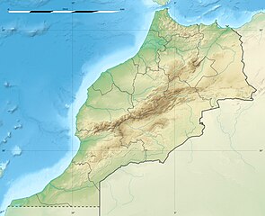
English: Blank physical map of Morocco, for geo-location purposes.
Français : Carte physique vierge du Maroc, destinée à la géolocalisation. Scale: 1:4,000,000 (precision: 1,000 m)
Geographic limits of the map:
|
||
| Siku | 2009-11, updated 2017-02 | ||
| Ukaboni |
Chinthu chane
|
||
| Mlembi | Eric Gaba (Sting - fr:Sting) | ||
| Chilolezo (Kugwiliskaso ntchito ichi) |
|
||
| Other versions |
|

| Camera location | | View this and other nearby images on: OpenStreetMap |
|---|
Chilolezo
I, the copyright holder of this work, hereby publish it under the following licenses:
Chinthu ichi ntchakuzomelezgeka na Creative Commons Attribution-Share Alike 3.0 Unported license.
- Ndimwe ŵakuzomelezgeka:
- kugaŵa – kuti mutandazge, kugaŵa na kusintha ntchito
- kusazga – kusintha chito iyi
- Pa malango ghakulondezga agha:
- Viyambilo vya kuchita – Mukwenela kupeleka malumbo ghawemi, kupeleka linki yakutyonda ku chilolezo, kweneso yowoyaniso pala vinyake vyasintha. Mukwenela kuchita nthena mwakwenelela, kwambula kujikhalila khonde.
- mwa kugaŵana – Pala mwasazga panji mwasintha chinthu, mukwenela kuchitandazga

|
Chilolezo ntchakupelekeka pakupanga copy, kutandazga panj kusintha na malango gha GNU Free Documentation License, Version 1.2 or any later version published by the Free Software Foundation; with no Invariant Sections, no Front-Cover Texts, and no Back-Cover Texts. A copy of the license is included in the section entitled GNU Free Documentation License. |
You may select the license of your choice.
Mbili ya chinthu
Dofyani pa siku/nyengo kuti muone umo vikaonekela pa nyengo iyo.
| Siku/Nyengo | Kachithuzi | Vipimo | Mgwiliski | Ganizo | |
|---|---|---|---|---|---|
| sono | 20:55, 10 Febuluwale 2017 | | 1,223 × 995 (265 KB) | Sting | Updated regions borders as since 2015 |
| 13:11, 19 Julayi 2010 |  | 1,223 × 995 (234 KB) | Sting | Color profile | |
| 20:31, 21 Novembala 2009 |  | 1,223 × 995 (240 KB) | Sting | Putting back the southern dotted boundary (regarding Western Sahara's location map) | |
| 01:23, 21 Novembala 2009 |  | 1,223 × 995 (239 KB) | Sting | Drawback for one "correction" | |
| 01:10, 21 Novembala 2009 |  | 1,223 × 995 (240 KB) | Sting | Several little corrections | |
| 00:09, 21 Novembala 2009 |  | 1,223 × 995 (241 KB) | Sting | == {{int:filedesc}} == {{Location|31|46|30|N|7|04|30|W|scale:5000000}} <br/> {{Information |Description={{en|Blank physical map of Morocco, for geo-location purposes.}} {{fr|Carte physique vierge du Maroc, destinée à la gé |
Magwiliskilo ntchito
The following page uses this file:
Umo chinthu chagwiliskikila ntchito
Ma wiki ghanyake agho ghakugwiliska ichi:
- Magwiliskilo pa af.wikipedia.org
- Magwiliskilo pa ar.wikipedia.org
- Magwiliskilo pa ast.wikipedia.org
- Magwiliskilo pa azb.wikipedia.org
- Magwiliskilo pa az.wikipedia.org
- Magwiliskilo pa ba.wikipedia.org
- Magwiliskilo pa be.wikipedia.org
- Magwiliskilo pa bg.wikipedia.org
Wonani magwiliskilo ghanandi ghapa charu gha chinthu ichi.