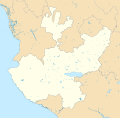
File:Mexico Jalisco location map.svg

Size of this PNG preview of this SVG file: 612 × 600 pixels. Mu misani inyake: 245 × 240 pixels | 490 × 480 pixels | 784 × 768 pixels | 1,045 × 1,024 pixels | 2,090 × 2,048 pixels | 2,511 × 2,461 pixels.
Chinthu cha kwenekuko (SVG file, nominally 2,511 × 2,461 pixels, file size: 2.49 MB)
Mbili ya chinthu
Dofyani pa siku/nyengo kuti muone umo vikaonekela pa nyengo iyo.
| Siku/Nyengo | Kachithuzi | Vipimo | Mgwiliski | Ganizo | |
|---|---|---|---|---|---|
| sono | 21:02, 26 Epulelo 2015 |  | 2,511 × 2,461 (2.49 MB) | Addicted04 | Fix |
| 20:46, 26 Epulelo 2015 |  | 2,511 × 2,461 (2.49 MB) | Addicted04 | New map (INEGI, 2014) | |
| 04:37, 30 Sekutembala 2011 |  | 2,618 × 2,502 (446 KB) | Battroid | {{ValidSVG}} {{Information |Description=Location Map of Jalisco Equirectangular projection, Geographic limits of the map: * N: 22.92° N * S: 18.58° N * W: 106.08° W * E: 101.29° W |Source={{own work}} |Date=2011-09-29 |Author=[[User:Ba |
Magwiliskilo ntchito
The following page uses this file:
Umo chinthu chagwiliskikila ntchito
Ma wiki ghanyake agho ghakugwiliska ichi:
- Magwiliskilo pa ar.wikipedia.org
- Magwiliskilo pa ba.wikipedia.org
- Magwiliskilo pa bg.wikipedia.org
- Magwiliskilo pa ceb.wikipedia.org
- Magwiliskilo pa ce.wikipedia.org
- Magwiliskilo pa de.wikipedia.org
- Puerto Vallarta
- Guadalajara (Mexiko)
- Chapalasee
- Colima (Vulkan)
- Tuxpan (Jalisco)
- Zapopan
- Tequila (Jalisco)
- Atenquique
- Ciudad Guzmán
- Nationalpark Nevado de Colima
- Mazamitla
- Cocula
- Totatiche
- Estadio Jalisco
- San Juan de los Lagos
- Wikipedia:Kartenwerkstatt/Positionskarten/Nordamerika
- Torrena
- Estadio Tres de Marzo
- Tlaquepaque
- Estadio Akron
- Chapala
- Ocotlán
- Vorlage:Positionskarte Mexiko Jalisco
- Barra de Navidad
- Bosque de la Primavera
- Ajijic
- Ameca (Jalisco)
- Velódromo Panamericano
- Puente Grande
- Tapalpa
- Guadalajara-Kartell
- Ojuelos de Jalisco
- Lagos de Moreno
- Encarnación de Díaz
- San Sebastián del Oeste
- Talpa de Allende
- Tonalá (Jalisco)
- Bolaños (Jalisco)
- Arena VFG
Wonani magwiliskilo ghanandi ghapa charu gha chinthu ichi.
