
File:Map of South Africa with Ukhahlamba highlighted (2011).svg

Size of this PNG preview of this SVG file: 684 × 599 pixels. Mu misani inyake: 274 × 240 pixels | 548 × 480 pixels | 876 × 768 pixels | 1,168 × 1,024 pixels | 2,337 × 2,048 pixels | 809 × 709 pixels.
Chinthu cha kwenekuko (SVG file, nominally 809 × 709 pixels, file size: 498 KB)
.svg)
Mwakudumula
| Malongosolelo |
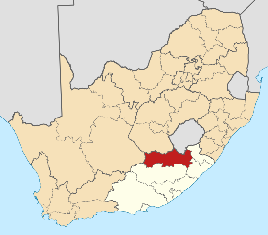
English: Map of district boundaries in South Africa, as they will be after the municipal elections of 18 May 2011, with the w:Ukhahlamba District Municipality highlighted in red within the Eastern Cape in yellow. |
| Siku | |
| Ukaboni | Chinthu chane |
| Mlembi | Htonl |
Chilolezo
I, the copyright holder of this work, hereby publish it under the following licenses:

|
Chilolezo ntchakupelekeka pakupanga copy, kutandazga panj kusintha na malango gha GNU Free Documentation License, Version 1.2 or any later version published by the Free Software Foundation; with no Invariant Sections, no Front-Cover Texts, and no Back-Cover Texts. A copy of the license is included in the section entitled GNU Free Documentation License. |
This file is licensed under the Creative Commons Attribution-Share Alike 4.0 International, 3.0 Unported, 2.5 Generic, 2.0 Generic and 1.0 Generic license.
- Ndimwe ŵakuzomelezgeka:
- kugaŵa – kuti mutandazge, kugaŵa na kusintha ntchito
- kusazga – kusintha chito iyi
- Pa malango ghakulondezga agha:
- Viyambilo vya kuchita – Mukwenela kupeleka malumbo ghawemi, kupeleka linki yakutyonda ku chilolezo, kweneso yowoyaniso pala vinyake vyasintha. Mukwenela kuchita nthena mwakwenelela, kwambula kujikhalila khonde.
- mwa kugaŵana – Pala mwasazga panji mwasintha chinthu, mukwenela kuchitandazga
You may select the license of your choice.
Mbili ya chinthu
Dofyani pa siku/nyengo kuti muone umo vikaonekela pa nyengo iyo.
| Siku/Nyengo | Kachithuzi | Vipimo | Mgwiliski | Ganizo | |
|---|---|---|---|---|---|
| sono | 13:59, 2 Meyi 2011 | | 809 × 709 (498 KB) | Htonl | == Summary == {{Information |Description ={{en|1=Map of district boundaries in South Africa, as they will be after the municipal elections of 18 May 2011, with the w:Ukhahlamba District Municipality high |
Magwiliskilo ntchito
The following 69 pages use this file:
- Aliwal Northe, Eastern Cape
- Barkly Easte, Eastern Cape
- Bebezae, Eastern Cape
- Bensonvalee, Eastern Cape
- Blikanae, Eastern Cape
- Blue Gumse, Eastern Cape
- Burgersdorpe, Eastern Cape
- Covillee, Eastern Cape
- Dilie, Eastern Cape
- Dontsie, Eastern Cape
- Dukatholee, Eastern Cape
- ETyinindinie, Eastern Cape
- Esilindini
- Fezile Dabi District Municipality
- Fort Hooke, Eastern Cape
- Herschel, Kapa Bohlabela
- Jamestowne, Eastern Cape
- Joe Gqabi District Municipality
- Khayamnandi, Steynsburg
- Khibae, Eastern Cape
- Khwezinaledie, Eastern Cape
- Kromspruit (village)
- Lady Grey, Kapa Bohlabela
- Maclear, Eastern Cape
- Madakanae, Eastern Cape
- Magalagaleni
- Makhethenge, Eastern Cape
- Mangwenie, Eastern Capee, Eastern Cape
- Marakanenge, Eastern Cape
- Maxeba
- Mayirenie, Eastern Cape
- Mboniswenie, Eastern Cape
- Mdenie, Eastern Cape
- Mdlokovana, Eastern Cape
- Mdlokovanee, Eastern Cape
- Meyie, Eastern Cape
- Mfinco
- Mlamlie, Eastern Cape
- Mount Fletcher, Eastern Cape
- Mtunzinie, Eastern Cape
- Musonge, Eastern Cape
- Mzamomhle, Burgersdorp
- New Rest, Senqu
- Nozizwe
- Ntsimekwenie, Eastern Cape
- Ovistone, Eastern Cape
- Palmietfontein, Kapa Bohlabela
- Pelandaba
- Rhodes, Kapa Bohlabela
- Rossouwe, Eastern Cape
- Sekotonge, Eastern Cape
- Skroone, Eastern Cape
- Sonwabile, Eastern Cape
- Sterkspruite, Eastern Cape
- Steve Tshwete, Lady Grey
- Steynsburge, Eastern Cape
- Teebuse, Eastern Cape
- Tembisa, Burgersdorp
- Thembeni, Eastern Cape
- Tienbanke, Eastern Cape
- Tinana, Eastern Cape
- Tokwana, Eastern Cape
- Tsekong, Eastern Cape
- Ugie, Eastern Cape
- Venterstad
- Voyizane
- Walazae, Eastern Cape
- Zakhelee, Eastern Cape
- Template:Joe Gqabi DM
Umo chinthu chagwiliskikila ntchito
Ma wiki ghanyake agho ghakugwiliska ichi:
- Magwiliskilo pa af.wikipedia.org
- Aliwal-Noord
- Maclear
- Barkly-Oos
- Ugie
- Burgersdorp
- Rhodes, Oos-Kaap
- Lady Grey
- Jamestown, Oos-Kaap
- Herschel
- Venterstad
- Mount Fletcher
- Steynsburg
- Oviston
- Sterkspruit
- Khayamnandi
- Mzamomhle, Burgersdorp
- Khwezinaledi
- Steve Tshwete, Lady Grey
- Sjabloonbespreking:Suid-Afrikaanse distriksmunisipaliteit navbox
- Teebus
- Rossouw, Oos-Kaap
- Zakhele
- Tembisa, Oos-Kaap
- Nozizwe
- Magwiliskilo pa ceb.wikipedia.org
- Magwiliskilo pa en.wikipedia.org
- Aliwal North
- Barkly East
- Joe Gqabi District Municipality
- Lady Grey, South Africa
- Template:Joe Gqabi District Municipality
- Rhodes, South Africa
- Oviston
- Burgersdorp
- Steynsburg
- Maclear, South Africa
- Jamestown, Eastern Cape
- Herschel, South Africa
- Venterstad
- Ugie, South Africa
- Mount Fletcher
- Sterkspruit
- Rossouw, South Africa
- Teebus
- Fairview, Barkly East
- User:GerardM/Districts of South Africa
- Magwiliskilo pa fr.wikipedia.org
- Magwiliskilo pa ha.wikipedia.org
- Magwiliskilo pa id.wikipedia.org
- Magwiliskilo pa ig.wikipedia.org
- Magwiliskilo pa lv.wikipedia.org
Wonani magwiliskilo ghanandi ghapa charu gha chinthu ichi.
.svg)
.svg)