
File:Map of Kentucky highlighting Henderson County.svg

Size of this PNG preview of this SVG file: 800 × 345 pixels. Mu misani inyake: 320 × 138 pixels | 640 × 276 pixels | 1,024 × 441 pixels | 1,280 × 551 pixels | 2,560 × 1,103 pixels | 6,770 × 2,916 pixels.
Chinthu cha kwenekuko (SVG file, nominally 6,770 × 2,916 pixels, file size: 127 KB)
Mwakudumula
| Malongosolelo |
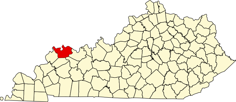
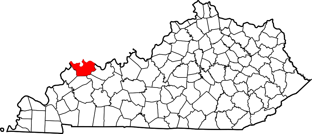
English: This is a locator map showing w:Anderson County, Bath County, Fayette County in Kentucky. For more information, see Commons:United States county locator maps. |
| Siku | |
| Ukaboni |
Chinthu chane: English: The maps use data from nationalatlas.gov, specifically countyp020.tar.gz on the Raw Data Download page. The maps also use state outline data from statesp020.tar.gz. The Florida maps use hydrogm020.tar.gz to display Lake Okeechobee. |
| Mlembi | David Benbennick |
Chilolezo
| I, the copyright holder of this work, release this work into the public domain. This applies worldwide. In some countries this may not be legally possible; if so: I grant anyone the right to use this work for any purpose, without any conditions, unless such conditions are required by law. |
Mbili ya chinthu
Dofyani pa siku/nyengo kuti muone umo vikaonekela pa nyengo iyo.
| Siku/Nyengo | Kachithuzi | Vipimo | Mgwiliski | Ganizo | |
|---|---|---|---|---|---|
| sono | 12:22, 12 Febuluwale 2006 | | 6,770 × 2,916 (127 KB) | David Benbennick | {{subst:User:Dbenbenn/clm|county=Henderson County|state=Kentucky}} |
Magwiliskilo ntchito
The following page uses this file:
Umo chinthu chagwiliskikila ntchito
Ma wiki ghanyake agho ghakugwiliska ichi:
- Magwiliskilo pa ar.wikipedia.org
- Magwiliskilo pa bg.wikipedia.org
- Magwiliskilo pa bpy.wikipedia.org
- Magwiliskilo pa cdo.wikipedia.org
- Magwiliskilo pa ceb.wikipedia.org
- Magwiliskilo pa ce.wikipedia.org
- Magwiliskilo pa cy.wikipedia.org
- Magwiliskilo pa de.wikipedia.org
- Magwiliskilo pa en.wikipedia.org
- Henderson County, Kentucky
- Corydon, Kentucky
- Henderson, Kentucky
- Robards, Kentucky
- Spottsville, Kentucky
- List of counties in Kentucky
- Scuffletown, Henderson County, Kentucky
- Template:Henderson County, Kentucky
- Diamond Island (Kentucky)
- User:Nyttend/County templates/KY/1
- National Register of Historic Places listings in Henderson County, Kentucky
- Audubon, Henderson
- Weaverton, Henderson County, Kentucky
- Category:Populated places in Henderson County, Kentucky
- Baskett, Kentucky
- Smith Mills, Kentucky
- Poole, Kentucky
- Reed, Kentucky
- Niagara, Kentucky
- Dixie, Henderson County, Kentucky
- Template:HendersonCountyKY-geo-stub
- Anthoston, Kentucky
- Magwiliskilo pa es.wikipedia.org
- Magwiliskilo pa et.wikipedia.org
- Magwiliskilo pa eu.wikipedia.org
- Magwiliskilo pa fa.wikipedia.org
Wonani magwiliskilo ghanandi ghapa charu gha chinthu ichi.