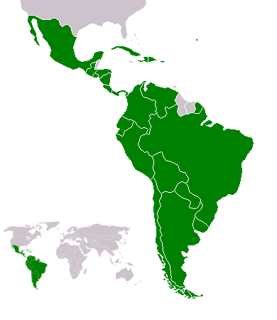
File:Map-Latin America2.png
Map-Latin_America2.png (390 × 450 pixels, file size: 22 KB, MIME type: image/png)
Mbili ya chinthu
Dofyani pa siku/nyengo kuti muone umo vikaonekela pa nyengo iyo.
| Siku/Nyengo | Kachithuzi | Vipimo | Mgwiliski | Ganizo | |
|---|---|---|---|---|---|
| sono | 22:23, 18 Febuluwale 2018 |  | 390 × 450 (22 KB) | Andrew J.Kurbiko | minor fix |
| 16:14, 20 Malichi 2011 |  | 390 × 450 (25 KB) | Philip Stevens | The Falkland Islands are not part of Latin America. | |
| 11:47, 7 Disembala 2008 |  | 390 × 450 (23 KB) | Osado | {{Information |Description= |Source= |Date= |Author= |Permission= |other_versions= }} | |
| 07:07, 20 Okutobala 2008 |  | 390 × 450 (21 KB) | Pruxo | malvinas part of latinoamerica | |
| 16:02, 15 Okutobala 2008 |  | 390 × 450 (21 KB) | Pruxo | mejora de "Imagen:Map-Latin America2.png", agregando islas en chile, agregando las Islas malvinas (o falklands) con color neutral, pasando la Guayana francesa junto con las demas guayanas (es territorio de ultramar frances, si fuera latinoamerica, quevec | |
| 21:55, 25 Febuluwale 2006 |  | 390 × 450 (22 KB) | NoIdeaNick~commonswiki | Changed map to reflect the fact that Jamaica is not part of Latin America. | |
| 14:36, 19 Janyuwale 2006 |  | 390 × 450 (23 KB) | NoIdeaNick~commonswiki | Just a little change to the color of Belize. | |
| 23:29, 21 Disembala 2005 |  | 390 × 450 (20 KB) | Yug | Zoom |
Magwiliskilo ntchito
Palije majani agho ghogwiliska chinthu ichi.
Umo chinthu chagwiliskikila ntchito
Ma wiki ghanyake agho ghakugwiliska ichi:
- Magwiliskilo pa af.wikipedia.org
- Magwiliskilo pa arc.wikipedia.org
- Magwiliskilo pa azb.wikipedia.org
- Magwiliskilo pa az.wikipedia.org
- Magwiliskilo pa br.wikipedia.org
- Magwiliskilo pa br.wiktionary.org
- Magwiliskilo pa ckb.wikipedia.org
- Magwiliskilo pa cv.wikipedia.org
- Magwiliskilo pa cy.wikipedia.org
- Magwiliskilo pa da.wikipedia.org
- Magwiliskilo pa de.wikipedia.org
- Magwiliskilo pa de.wiktionary.org
- Magwiliskilo pa en.wikipedia.org
- Latin America
- User:Dimadick
- Afro–Latin Americans
- User:Nivenus
- Wikipedia:Featured content/Portals
- User:Mikhajist
- User:Zdunne
- User:CatatonicStupor
- Wikipedia:Association of Hispanic and Latin American writers
- User:J. Finkelstein/Sandbox/LatinAmericaInfobox
- User:Es-arturus
- Etiquette in Latin America
- Water supply and sanitation in Latin America
- User:Adam sk
- Wikipedia:Articles for deletion/Log/2007 February 10
- Wikipedia:Articles for deletion/Latino Muslims
- Talk:Latin America/Archive 1
- User:Mvblair
- User:Tcd88
- User:Mikhajist/Userboxes
- User:Zero Gravity/Proposal
- User:Andreasmperu
- Wikipedia:Graphics Lab/Image workshop/Archive/May 2009
- User:Mosemamenti
- User:Mvblair/Userboxes/Latin American History
- User:Richie Boy 5
- Template talk:Wikipedia ads/Archive 1
- User:Mosemamenti/Usuario:Mosemamenti
- User:Fcassia
- User:Saukkomies/My userboxes
- User:IANVS
- User:AKABumba
- User:Daguerrero
- User:Clarkp/Userboxes
- User:Hpav7
- User:Evanex
Wonani magwiliskilo ghanandi ghapa charu gha chinthu ichi.


