
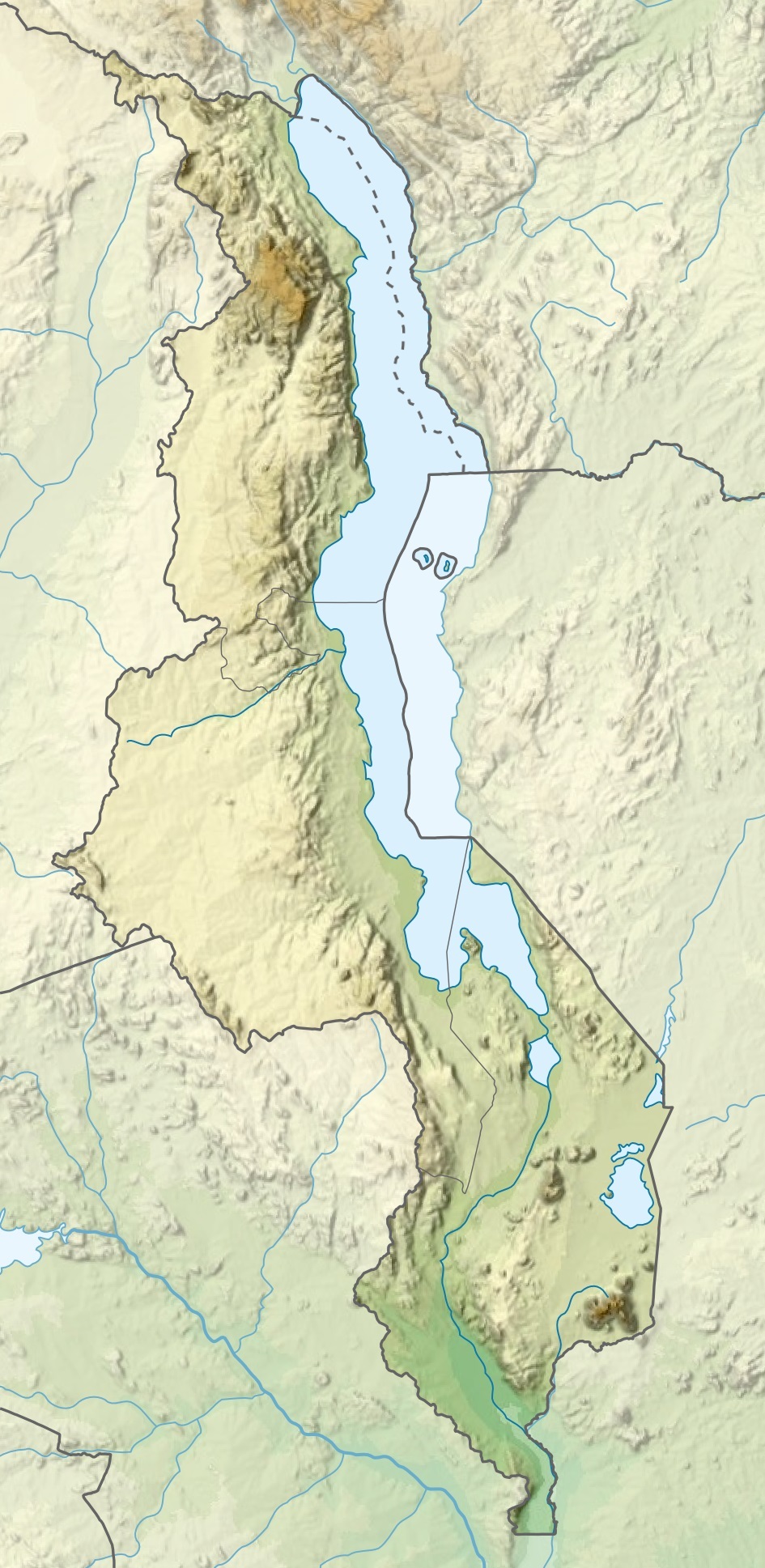
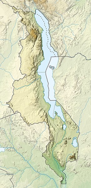
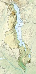
File:Malawi relief location map.jpg
Saizi ya chakuona ichi: 292 × 599 pixels. Mu misani inyake: 117 × 240 pixels | 234 × 480 pixels | 945 × 1,937 pixels.
Chinthu cha kwenekuko (945 × 1,937 pixels, file size: 487 KB, MIME type: image/jpeg)
Mwakudumula
| Malongosolelo |
Español: Mapa de localización de Malaui
Deutsch: Positionskarte von Malawi
Quadratische Plattkarte. Geographische Begrenzung der Karte:
English: Location map of Malawi
Equirectangular projection. Geographic limits of the map:
|
| Siku | |
| Ukaboni |
This file was derived from: |
| Mlembi |
|
Chilolezo
I, the copyright holder of this work, hereby publish it under the following licenses:

|
Chilolezo ntchakupelekeka pakupanga copy, kutandazga panj kusintha na malango gha GNU Free Documentation License, Version 1.2 or any later version published by the Free Software Foundation; with no Invariant Sections, no Front-Cover Texts, and no Back-Cover Texts. A copy of the license is included in the section entitled GNU Free Documentation License. |
Chinthu ichi ntchakuzomelezgeka na Creative Commons Attribution-Share Alike 3.0 Unported license.
- Ndimwe ŵakuzomelezgeka:
- kugaŵa – kuti mutandazge, kugaŵa na kusintha ntchito
- kusazga – kusintha chito iyi
- Pa malango ghakulondezga agha:
- Viyambilo vya kuchita – Mukwenela kupeleka malumbo ghawemi, kupeleka linki yakutyonda ku chilolezo, kweneso yowoyaniso pala vinyake vyasintha. Mukwenela kuchita nthena mwakwenelela, kwambula kujikhalila khonde.
- mwa kugaŵana – Pala mwasazga panji mwasintha chinthu, mukwenela kuchitandazga
You may select the license of your choice.
Mbili ya chinthu
Dofyani pa siku/nyengo kuti muone umo vikaonekela pa nyengo iyo.
| Siku/Nyengo | Kachithuzi | Vipimo | Mgwiliski | Ganizo | |
|---|---|---|---|---|---|
| sono | 20:29, 3 Malichi 2020 | | 945 × 1,937 (487 KB) | Sémhur | Adding Tanzanian border claim (from https://www.nbs.go.tz/index.php/en/census-surveys/gis/385-2012-phc-shapefiles-level-one-and-two) |
| 19:26, 20 Janyuwale 2015 |  | 945 × 1,937 (499 KB) | Milenioscuro | User created page with UploadWizard |
Magwiliskilo ntchito
The following 11 pages use this file:
Umo chinthu chagwiliskikila ntchito
Ma wiki ghanyake agho ghakugwiliska ichi:
- Magwiliskilo pa af.wikipedia.org
- Magwiliskilo pa ast.wikipedia.org
- Magwiliskilo pa avk.wikipedia.org
- Magwiliskilo pa az.wikipedia.org
- Magwiliskilo pa ban.wikipedia.org
- Magwiliskilo pa be.wikipedia.org
- Magwiliskilo pa bg.wikipedia.org
- Magwiliskilo pa bn.wikipedia.org
- Magwiliskilo pa da.wikipedia.org
- Magwiliskilo pa de.wikipedia.org
- Malawi
- Malawisee
- Mulanje (Bergmassiv)
- Kapichira-Wasserfälle
- Shire-Hochland
- Elephant Marsh
- Malombesee
- Chilwa-See
- Nyika-Plateau
- Chizumulu
- Nchenachena
- Nganda
- Salanjama
- Kasungu-Nationalpark
- Viphya Mountains
- Chongoni
- Vorlage:Positionskarte Malawi
- Wikipedia:Kartenwerkstatt/Positionskarten/Afrika
- Chisi Island
- Kaulime-See
- Likoma (Insel)
Wonani magwiliskilo ghanandi ghapa charu gha chinthu ichi.