
File:Island of Ireland location map Londonderry.svg

Size of this PNG preview of this SVG file: 796 × 599 pixels. Mu misani inyake: 319 × 240 pixels | 638 × 480 pixels | 1,020 × 768 pixels | 1,280 × 964 pixels | 2,560 × 1,928 pixels | 931 × 701 pixels.
Chinthu cha kwenekuko (SVG file, nominally 931 × 701 pixels, file size: 826 KB)
| Malongosolelo |
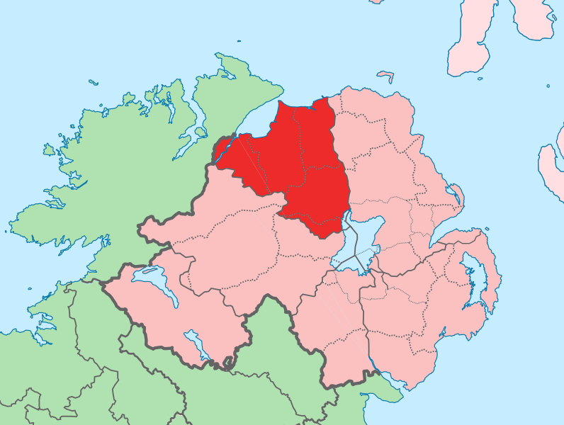
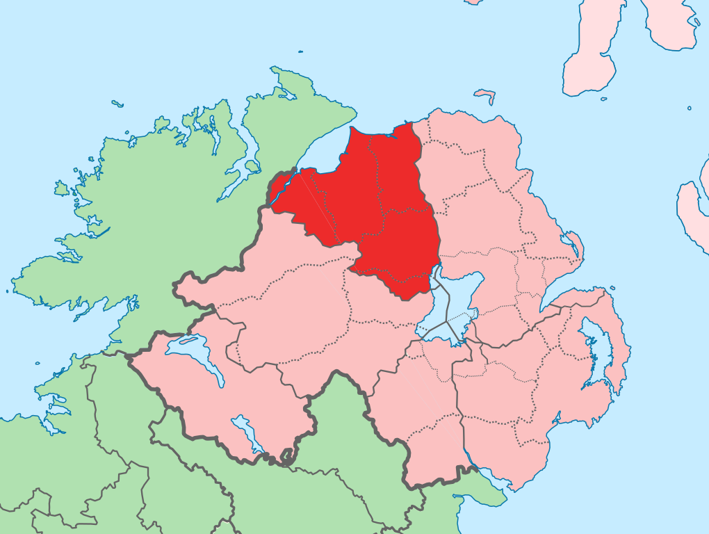
English: The island of Ireland, showing international border between Ireland and Northern Ireland, traditional provinces, traditional counties, and local authority areas in Ireland and Northern Ireland. |
| Siku | (UTC) |
| Ukaboni | |
| Mlembi |
|
| This is a retouched picture, which means that it has been digitally altered from its original version. Modifications: Added colours to distinguish county in focus. The original can be viewed here: Island of Ireland location map.svg:
|
I, the copyright holder of this work, hereby publish it under the following license:
Chinthu ichi ntchakuzomelezgeka na Creative Commons Attribution-Share Alike 3.0 Unported license.
- Ndimwe ŵakuzomelezgeka:
- kugaŵa – kuti mutandazge, kugaŵa na kusintha ntchito
- kusazga – kusintha chito iyi
- Pa malango ghakulondezga agha:
- Viyambilo vya kuchita – Mukwenela kupeleka malumbo ghawemi, kupeleka linki yakutyonda ku chilolezo, kweneso yowoyaniso pala vinyake vyasintha. Mukwenela kuchita nthena mwakwenelela, kwambula kujikhalila khonde.
- mwa kugaŵana – Pala mwasazga panji mwasintha chinthu, mukwenela kuchitandazga
Original upload log
This image is a derivative work of the following images:
- File:Island_of_Ireland_location_map.svg licensed with Cc-by-sa-3.0
- 2010-03-06T20:43:33Z Rannpháirtí anaithnid 1450x1807 (679207 Bytes) Fix incorrectly coloured isands.
- 2010-03-03T22:19:29Z Rannpháirtí anaithnid 1450x1807 (679744 Bytes) {{Information |Description={{de|Positionskarte von [[:de:Irland|Irland]]}} Quadratische Plattkarte, N-S-Streckung 170 %. Geographische Begrenzung der Karte: * N: 55.6° N * S: 51.2° N * W: 11.0° W * O: 5.0° W {{en|Location
Uploaded with derivativeFX
Mbili ya chinthu
Dofyani pa siku/nyengo kuti muone umo vikaonekela pa nyengo iyo.
| Siku/Nyengo | Kachithuzi | Vipimo | Mgwiliski | Ganizo | |
|---|---|---|---|---|---|
| sono | 13:14, 19 Julayi 2010 | | 931 × 701 (826 KB) | Mabuska | another attempt |
| 13:07, 19 Julayi 2010 |  | 931 × 701 (826 KB) | Mabuska | attempt to fix boundary issues | |
| 11:36, 19 Julayi 2010 |  | 934 × 717 (828 KB) | Mabuska | {{Information |Description={{en|The island of Ireland, showing international border between Northern Ireland and Republic of Ireland, traditional provinces, traditional counties, and local authority areas in the Republic of Ireland and Northern Ireland.}} |
Magwiliskilo ntchito
The following page uses this file:
Umo chinthu chagwiliskikila ntchito
Ma wiki ghanyake agho ghakugwiliska ichi:
- Magwiliskilo pa an.wikipedia.org
- Magwiliskilo pa bg.wikipedia.org
- Magwiliskilo pa cs.wikipedia.org
- Magwiliskilo pa de.wikipedia.org
- Magwiliskilo pa en.wikipedia.org
- Derry
- County Londonderry
- Limavady
- Dungiven
- Sperrins
- Coleraine
- Portstewart
- Moneymore
- Draperstown
- List of Ireland-related topics
- Maghera
- Corick
- Magilligan
- Lough Foyle
- List of places in Northern Ireland
- Magherafelt
- Bogside
- Free Derry Corner
- List of places in County Londonderry
- Ballynahone Bog
- Binevenagh
- Castledawson
- Glenshane Pass
- Drumsurn
- Ballykelly, County Londonderry
- Swatragh
- Castlerock
- Newbuildings
- Ballynagalliagh
- Shantallow
- Eglinton, County Londonderry
- Claudy
- Articlave
- Bellaghy
- Clady, County Londonderry
- Culmore
- Burnfoot, County Londonderry
- Downhill, County Londonderry
- Feeny
- Garvagh
- Greysteel
- Kilrea
- Lettershandoney
- Macosquin
- Strathfoyle
- Tobermore
Wonani magwiliskilo ghanandi ghapa charu gha chinthu ichi.