
File:Europe location ARM.png

Saizi ya chakuona ichi: 800 × 600 pixels. Mu misani inyake: 320 × 240 pixels | 640 × 480 pixels | 1,024 × 768 pixels | 1,280 × 960 pixels | 1,600 × 1,200 pixels.
Chinthu cha kwenekuko (1,600 × 1,200 pixels, file size: 152 KB, MIME type: image/png)
| Malongosolelo |
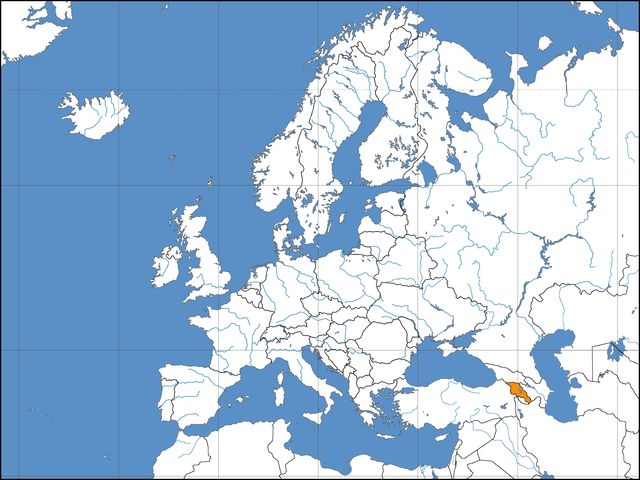
Deutsch: Lage der Republik Armenien in Europa Stand: October 2006 |
||||||||
| Siku | |||||||||
| Ukaboni | Based on work by David Liuzzo | ||||||||
| Mlembi | Aivazovsky | ||||||||
| Chilolezo (Kugwiliskaso ntchito ichi) |
I, the copyright holder of this work, hereby publish it under the following licenses:
This file is licensed under the Creative Commons Attribution-Share Alike 2.0 Germany license.
 You may select the license of your choice. |

Mbili ya chinthu
Dofyani pa siku/nyengo kuti muone umo vikaonekela pa nyengo iyo.
| Siku/Nyengo | Kachithuzi | Vipimo | Mgwiliski | Ganizo | |
|---|---|---|---|---|---|
| sono | 23:35, 2 Janyuwale 2007 | | 1,600 × 1,200 (152 KB) | Aivazovsky~commonswiki | Reverted to earlier revision |
| 19:15, 1 Janyuwale 2007 |  | 1,600 × 1,200 (160 KB) | IAMTHEEGGMAN | Reverted to earlier revision | |
| 17:12, 19 Novembala 2006 |  | 1,600 × 1,200 (152 KB) | Aivazovsky~commonswiki | ||
| 04:12, 8 Novembala 2006 |  | 1,600 × 1,200 (160 KB) | Arniep | Reverted to earlier revision | |
| 04:04, 8 Novembala 2006 |  | 1,600 × 1,200 (137 KB) | Eupator | Reverted to earlier revision | |
| 01:36, 8 Novembala 2006 |  | 1,600 × 1,200 (160 KB) | DLiuzzo | '''STOP CHANGING THE MAP!!!''' '''Don't Change the Borders on MY MAPS!!!''' {{Information| |Description={{de|Politische Karte des Kontinents Europa. Leere Lagekarte zur Darstellung der Lage von Staaten in Europa. Europa ist grau hervorgehoben.}} |Source | |
| 01:22, 8 Novembala 2006 |  | 1,600 × 1,200 (137 KB) | Eupator | Reverted to earlier revision | |
| 00:55, 8 Novembala 2006 |  | 1,600 × 1,200 (160 KB) | DLiuzzo | {{Information| |Description={{de|Politische Karte des Kontinents Europa. Leere Lagekarte zur Darstellung der Lage von Staaten in Europa. Europa ist grau hervorgehoben.}} |Source= Own Work |Date= 02.11.2006 |Author= David Liuzzo |Perm | |
| 21:43, 7 Novembala 2006 |  | 1,600 × 1,200 (137 KB) | Khoikhoi~commonswiki | Reverted to earlier revision | |
| 06:52, 6 Novembala 2006 |  | 1,600 × 1,200 (160 KB) | DLiuzzo | {{Information| |Description={{de|Politische Karte des Kontinents Europa. Leere Lagekarte zur Darstellung der Lage von Staaten in Europa. Europa ist grau hervorgehoben.}} |Source= Own Work |Date= 02.11.2006 |Author= David Liuzzo |Perm |
Magwiliskilo ntchito
The following 2 pages use this file:
Umo chinthu chagwiliskikila ntchito
Ma wiki ghanyake agho ghakugwiliska ichi:
- Magwiliskilo pa als.wikipedia.org
- Magwiliskilo pa as.wikipedia.org
- Magwiliskilo pa av.wikipedia.org
- Magwiliskilo pa bat-smg.wikipedia.org
- Magwiliskilo pa bh.wikipedia.org
- Magwiliskilo pa bn.wikipedia.org
- Magwiliskilo pa bo.wikipedia.org
- Magwiliskilo pa da.wikipedia.org
- Magwiliskilo pa de.wiktionary.org
- Magwiliskilo pa dv.wikipedia.org
- Magwiliskilo pa eml.wikipedia.org
- Magwiliskilo pa en.wikipedia.org
- Magwiliskilo pa fa.wikipedia.org
- Magwiliskilo pa fo.wikipedia.org
- Magwiliskilo pa kg.wikipedia.org
- Magwiliskilo pa mai.wikipedia.org
- Magwiliskilo pa mk.wikipedia.org
- Magwiliskilo pa ne.wikipedia.org
- Magwiliskilo pa pa.wikipedia.org
- Magwiliskilo pa pdc.wikipedia.org
- Magwiliskilo pa pt.wiktionary.org
Wonani magwiliskilo ghanandi ghapa charu gha chinthu ichi.