File:Camajuani Map.png

Page contents not supported in other languages.
Kufuma Wikipedia

Camajuani_Map.png(328 × 532 pixels, file size: 63 KB, MIME type: image/png)

Chinthu ichi ntchaku Wikimedia Commons ndipo chingagwiliskikaso kunyake. Vakulongosola vake file description page vili pasi apa.

Mwakudumula

Malongosolelo
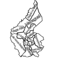
English: Map of Camajuaní’s Wards and towns. Black with red dots are the 2 major cities (Camajuaní and Vueltas). The red dots are popular areas for tourism (like Playa Juan Francisco) and larger towns (like Taguaybon, La Quinta, etc) yellow are small towns, hamlets, and CPA (like Crucero Carmita, Tarafa, and Puente Pavon) and green are populated regions not on the map I based this on but on OSM.
Siku
Ukaboni Chinthu chane
Mlembi CubanoBoi

Chilolezo

I, the copyright holder of this work, hereby publish it under the following license:
w:en:Creative Commons
Viyambilo vya kuchita mwa kugaŵana
This file is licensed under the Creative Commons Attribution-Share Alike 4.0 International license.
Ndimwe ŵakuzomelezgeka:
  • kugaŵa – kuti mutandazge, kugaŵa na kusintha ntchito
  • kusazga – kusintha chito iyi
Pa malango ghakulondezga agha:
  • Viyambilo vya kuchita – Mukwenela kupeleka malumbo ghawemi, kupeleka linki yakutyonda ku chilolezo, kweneso yowoyaniso pala vinyake vyasintha. Mukwenela kuchita nthena mwakwenelela, kwambula kujikhalila khonde.
  • mwa kugaŵana – Pala mwasazga panji mwasintha chinthu, mukwenela kuchitandazga
na dango la same or compatible license nga ntchiphya.

Captions

Add a one-line explanation of what this file represents
Map of Camajuaní’s People’s Council

Items portrayed in this file

depicts English

creator English

some value

author name string English: CubanoBoi

copyrighted English

inception English

4 Julayi 2022

media type English

image/png

checksum English

8dc0c67d670b5d71c86bf777cf1159068c38b3d9

determination method English: SHA-1 English

data size English

64,591 byte

height English

532 pixel

width English

328 pixel

Mbili ya chinthu

Dofyani pa siku/nyengo kuti muone umo vikaonekela pa nyengo iyo.

Siku/NyengoKachithuziVipimoMgwiliskiGanizo
sono21:45, 14 Epulelo 2023Kachithuzi kachoko nga mpha 21:45, 14 Epulelo 2023328 × 532 (63 KB)CubanoBoiAdded Vega Alta which I forgot
21:39, 14 Epulelo 2023Kachithuzi kachoko nga mpha 21:39, 14 Epulelo 2023328 × 532 (52 KB)CubanoBoiFixed borders and to only 9 since that’s how many the official website said they were. Borders are not official and I added towns.
17:19, 16 Julayi 2022Kachithuzi kachoko nga mpha 17:19, 16 Julayi 20221,280 × 1,280 (415 KB)CubanoBoiUsed outline used on https://www.soycamajuani.gob.cu/es/nuestra-region/region-camajuani/sobre-nosotros
17:08, 5 Julayi 2022Kachithuzi kachoko nga mpha 17:08, 5 Julayi 20223,072 × 3,072 (1.56 MB)CubanoBoiRoberto Rodriguez is not Vega Alta
02:26, 5 Julayi 2022Kachithuzi kachoko nga mpha 02:26, 5 Julayi 20223,072 × 3,072 (1.57 MB)CubanoBoiEl Cubano is more left
01:29, 5 Julayi 2022Kachithuzi kachoko nga mpha 01:29, 5 Julayi 20223,072 × 3,072 (1.59 MB)CubanoBoiPavón and Puente Pavón aren’t Vega Alta
00:22, 5 Julayi 2022Kachithuzi kachoko nga mpha 00:22, 5 Julayi 20222,048 × 2,048 (896 KB)CubanoBoiEl Cubano is Vega Alta
23:27, 4 Julayi 2022Kachithuzi kachoko nga mpha 23:27, 4 Julayi 20222,048 × 2,048 (900 KB)CubanoBoiFixed Camajuani, and fixed other borders
23:05, 4 Julayi 2022Kachithuzi kachoko nga mpha 23:05, 4 Julayi 20222,048 × 2,048 (869 KB)CubanoBoiAdded Detail
22:25, 4 Julayi 2022Kachithuzi kachoko nga mpha 22:25, 4 Julayi 20224,096 × 4,096 (2.29 MB)CubanoBoiUploaded own work with UploadWizard

The following page uses this file:

Umo chinthu chagwiliskikila ntchito

Ma wiki ghanyake agho ghakugwiliska ichi: