
File:Baltimore osm-mapnik location map.png
Palije saizi ikulu.
Baltimore_osm-mapnik_location_map.png (490 × 475 pixels, file size: 349 KB, MIME type: image/png)
Mwakudumula
| Malongosolelo |
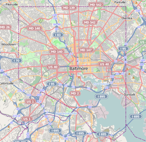
English: Map of Baltimore
Geographic limits of the map:
|
| Siku | |
| Ukaboni | http://www.openstreetmap.org |
| Mlembi | OpenStreetMap contributors |
| Chilolezo (Kugwiliskaso ntchito ichi) |
Cartography is licensed as CC-BY-SA (http://www.openstreetmap.org/copyright) |
Chilolezo
| This work contains information from OpenStreetMap, which is made available under the Open Database License (ODbL).
The ODbL does not require any particular license for maps produced from ODbL data. Prior to 1 August 2020, map tiles produced by the OpenStreetMap Foundation were licensed under the CC-BY-SA-2.0 license. Maps produced by other people may be subject to other licences. |
This file is licensed under the Creative Commons Attribution-Share Alike 2.0 Generic license.
- Ndimwe ŵakuzomelezgeka:
- kugaŵa – kuti mutandazge, kugaŵa na kusintha ntchito
- kusazga – kusintha chito iyi
- Pa malango ghakulondezga agha:
- Viyambilo vya kuchita – Mukwenela kupeleka malumbo ghawemi, kupeleka linki yakutyonda ku chilolezo, kweneso yowoyaniso pala vinyake vyasintha. Mukwenela kuchita nthena mwakwenelela, kwambula kujikhalila khonde.
- mwa kugaŵana – Pala mwasazga panji mwasintha chinthu, mukwenela kuchitandazga
Mbili ya chinthu
Dofyani pa siku/nyengo kuti muone umo vikaonekela pa nyengo iyo.
| Siku/Nyengo | Kachithuzi | Vipimo | Mgwiliski | Ganizo | |
|---|---|---|---|---|---|
| sono | 21:29, 13 Disembala 2012 | | 490 × 475 (349 KB) | Alexrk2 | {{Information |Description={{en|1=Map of Baltimore Geographic limits of the map: * N: 39.3805° * S: 39.1953° * W: -76.7426° * E: -76.4957° }} |Source=http://www.openstreetmap.org |Author=OpenStreetMap contributors |Date=2012-12 |Permission=Cart... |
Magwiliskilo ntchito
The following 2 pages use this file:
Umo chinthu chagwiliskikila ntchito
Ma wiki ghanyake agho ghakugwiliska ichi:
- Magwiliskilo pa ar.wikipedia.org
- Magwiliskilo pa arz.wikipedia.org
- Magwiliskilo pa bh.wikipedia.org
- Magwiliskilo pa ceb.wikipedia.org
- Magwiliskilo pa en.wikipedia.org
- NS Savannah
- Oriole Park at Camden Yards
- M&T Bank Stadium
- SS John W. Brown
- USCGC Taney
- Inner Harbor
- USS Torsk
- United States lightship Chesapeake (LV-116)
- Fell's Point, Baltimore
- Westminster Hall and Burying Ground
- B&O Railroad Museum
- Locust Point, Baltimore
- Federal Hill, Baltimore
- Hampden, Baltimore
- Little Italy, Baltimore
- Congregation Tiferes Yisroel
- Canton, Baltimore
- Bolton Hill, Baltimore
- Phoenix Shot Tower
- Pigtown, Baltimore
- Lyric Performing Arts Center
- Peale Museum
- Armistead Gardens, Baltimore
- Mount Washington, Baltimore
- Curtis Bay, Baltimore
- Abell, Baltimore
- Template:Infobox hospital
- Baltimore Hebrew Congregation
- Reservoir Hill, Baltimore
- Upton, Baltimore
- Butchers Hill, Baltimore
- Washington Hill, Baltimore
- McElderry Park, Baltimore
- Carrollton Viaduct
- Cylburn Arboretum
- Loudon Park National Cemetery
- Jewish Museum of Maryland
- Greektown, Baltimore
- Highlandtown, Baltimore
- Brewers Hill, Baltimore
- Hamilton Hills, Baltimore
- Union Square, Baltimore
- Dickeyville Historic District
Wonani magwiliskilo ghanandi ghapa charu gha chinthu ichi.