
File:CHN orthographic.svg

Size of this PNG preview of this SVG file: 550 × 550 pixels. Mu misani inyake: 240 × 240 pixels | 480 × 480 pixels | 768 × 768 pixels | 1,024 × 1,024 pixels | 2,048 × 2,048 pixels.
Chinthu cha kwenekuko (SVG file, nominally 550 × 550 pixels, file size: 1.46 MB)
Mwakudumula
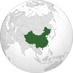
| Malongosolelo | China orthographic map |
| Siku |
|
| Ukaboni |
Chinthu chane |
| Mlembi |
Addicted04 |
.svg)
.svg)
.svg)
.svg)
.svg)
.svg)
.svg)
.svg)
.svg)
.svg)
.svg)
.svg)
.svg)
.svg)
.svg)
.svg)
.svg)
.svg)
.svg)
.svg)
.svg)
.svg)
.svg)
.svg)
.svg)
.svg)
.svg)
.svg)
.svg)
.svg)
.svg)
.svg)
.svg)
.svg)
.svg)
.svg)
.svg)
.svg)
.svg)
.svg)
.svg)
.svg)
.svg)
.svg)
.svg)
.svg)
.svg)
.svg)
.svg)
.svg)
.svg)
.svg)
.svg)
.svg)
.svg)
.svg)
.svg)
.svg)
.svg)
.svg)
.svg)
.svg)
.svg)
.svg)
.svg)
.svg)
.svg)
.svg)
.svg)
.svg)
.svg)
.svg)
.svg)
.svg)

.svg)

.svg)

.svg)
.svg)
.svg)
.svg)
.svg)
.svg)
.svg)


.svg)
.svg)
.svg)
.svg)
.svg)
.svg)
.svg)

.svg)
.svg)
.svg)
.svg)
.svg)
.svg)
.svg)
.svg)
.svg)

.svg)
.svg)
.svg)
.svg)
.svg)
.svg)
.svg)
_without_national_boundaries.svg)
.svg)
.svg)
.svg)
.svg)
.svg)
.svg)

.svg)
.svg)
.png)
.svg)
.svg)
.svg)
.svg)

.svg)
.svg)
.svg)
.svg)
.svg)
.svg)
.svg)
.svg)
.svg)
.svg)
.svg)

.svg)
.svg)
.svg)
.svg)
.svg)
.svg)
.svg)
.svg)
.svg)

.svg)
.svg)

.svg)
.svg)
.svg)
.svg)
.svg)
.svg)
.svg)
.svg)
.svg)
.svg)
.svg)
.svg)
.svg)
.svg)
.svg)
.svg)
.svg)
.svg)
.svg)
.svg)
.svg)
.svg)
.svg)
.svg)
.svg)
.svg)
.svg)
_-_Crimea_disputed.svg)
.svg)
.svg)
.svg)
.svg)
.svg)
.svg)
.svg)
.svg)
.svg)
.svg)
.svg)
_political.svg)
.svg)
.svg)
.svg)
.svg)
_-_Crimea_disputed_-_no_borders.svg)
.svg)
.svg)
.svg)
.svg)
.svg)
.svg)
.svg)
.svg)
.svg)
.svg)
.svg)

.svg)
.svg)
.svg)

.png)
.svg)
.svg)
.svg)
.svg)
.svg)
.svg)
.svg)
.svg)
.svg)
.svg)
.svg)
.svg)
.svg)
.svg)
.svg)
.svg)
.svg)
.svg)
.svg)
.svg)
.svg)
.svg)
.svg)
.svg)
.svg)
.svg)
.svg)
.svg)
.svg)
.svg)
.svg)
.svg)
.svg)
.svg)
.png)
.svg)
.svg)
.svg)
_(orthographic_projection).png)
| Orthographic projections maps created by Ssolbergj |
|---|
| Orthographic projections maps created by Ssolbergj: |
.svg)
.svg)
| Annotations | This image is annotated: View the annotations at Commons |
Chilolezo
I, the copyright holder of this work, hereby publish it under the following license:
Chinthu ichi ntchakuzomelezgeka na Creative Commons Attribution-Share Alike 3.0 Unported license.
- Ndimwe ŵakuzomelezgeka:
- kugaŵa – kuti mutandazge, kugaŵa na kusintha ntchito
- kusazga – kusintha chito iyi
- Pa malango ghakulondezga agha:
- Viyambilo vya kuchita – Mukwenela kupeleka malumbo ghawemi, kupeleka linki yakutyonda ku chilolezo, kweneso yowoyaniso pala vinyake vyasintha. Mukwenela kuchita nthena mwakwenelela, kwambula kujikhalila khonde.
- mwa kugaŵana – Pala mwasazga panji mwasintha chinthu, mukwenela kuchitandazga

|
WARNING! According to Chinese Law, producing, selling and advertising maps or other items, both in electronic and print versions, that do not conform to the territorial claims of the Chinese government is prohibited. |
Mbili ya chinthu
Dofyani pa siku/nyengo kuti muone umo vikaonekela pa nyengo iyo.
| Siku/Nyengo | Kachithuzi | Vipimo | Mgwiliski | Ganizo | |
|---|---|---|---|---|---|
| sono | 06:04, 11 Febuluwale 2020 | | 550 × 550 (1.46 MB) | 芄蘭 | Reverted to version as of 14:28, 31 July 2019 (UTC) |
| 13:02, 10 Febuluwale 2020 |  | 720 × 722 (334 KB) | Abhishek65628 | Reverted to version as of 15:44, 25 July 2019 (UTC) | |
| 14:28, 31 Julayi 2019 |  | 550 × 550 (1.46 MB) | The Account 1 | Reverted to version as of 22:59, 22 October 2011 (UTC) China still claims Arunachal Pradesh | |
| 15:44, 25 Julayi 2019 |  | 720 × 722 (334 KB) | Lakshmisreekanth | Updated image | |
| 22:59, 22 Okutobala 2011 |  | 550 × 550 (1.46 MB) | Addicted04 | claimed color | |
| 22:03, 22 Okutobala 2011 |  | 550 × 550 (1.46 MB) | Addicted04 |
Magwiliskilo ntchito
The following page uses this file:
Umo chinthu chagwiliskikila ntchito
Ma wiki ghanyake agho ghakugwiliska ichi:
- Magwiliskilo pa am.wikipedia.org
- Magwiliskilo pa ar.wikipedia.org
- الصين
- مستخدم:جار الله/قائمة صور مقالات العلاقات الثنائية
- العلاقات الأنغولية الصينية
- العلاقات الصينية الكورية الجنوبية
- العلاقات الصينية الإريترية
- العلاقات الصينية السويسرية
- العلاقات الألمانية الصينية
- العلاقات الصينية الليختنشتانية
- العلاقات الصينية البوليفية
- العلاقات الصينية الموزمبيقية
- العلاقات الصينية البلجيكية
- العلاقات الصينية الإثيوبية
- العلاقات الصينية البيلاروسية
- العلاقات الصينية الطاجيكية
- العلاقات الصينية الروسية منذ عام 1991
- العلاقات الصينية الرومانية
- العلاقات الأرجنتينية الصينية
- العلاقات الصينية الغامبية
- العلاقات الصينية القبرصية
- العلاقات الصينية السيراليونية
- العلاقات الصينية النيبالية
- العلاقات الصينية الليبيرية
- العلاقات التشيكية الصينية
- العلاقات الصينية الميانمارية
- العلاقات الصينية الزيمبابوية
- العلاقات الصينية البالاوية
- العلاقات الصينية المالية
- العلاقات الصينية النيجيرية
- العلاقات الصينية الفانواتية
- العلاقات الصينية الغابونية
- العلاقات الصينية البنمية
- العلاقات الصينية الكوبية
- العلاقات الصينية الجورجية
- العلاقات التونسية الصينية
- العلاقات الصينية الهندية
- العلاقات الصينية الإيطالية
- العلاقات الصينية الناوروية
- العلاقات الأسترالية الصينية
- العلاقات الزامبية الصينية
- العلاقات الصينية الفيجية
- العلاقات الصينية المارشالية
- العلاقات الأذربيجانية الصينية
- العلاقات الصينية الكونغوية
- العلاقات الصينية الدومينيكانية
- العلاقات البرازيلية الصينية
- العلاقات الصينية الغرينادية
- العلاقات الصينية الكازاخستانية
- العلاقات الصينية الكوستاريكية
- العلاقات الصينية الصربية
Wonani magwiliskilo ghanandi ghapa charu gha chinthu ichi.