
File:Europe countries map en 2.png

Saizi ya chakuona ichi: 737 × 599 pixels. Mu misani inyake: 295 × 240 pixels | 590 × 480 pixels | 944 × 768 pixels | 1,259 × 1,024 pixels | 1,473 × 1,198 pixels.
Chinthu cha kwenekuko (1,473 × 1,198 pixels, file size: 1.16 MB, MIME type: image/png)
Mwakudumula
| Malongosolelo |
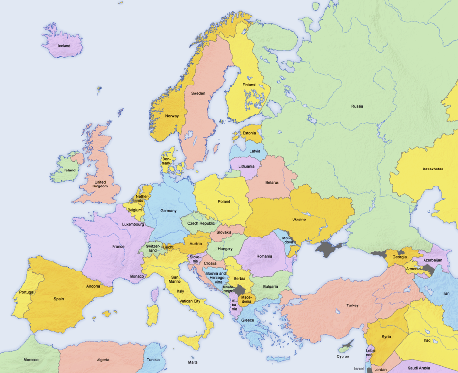
English: Map of countries in Europe and the surrounding region |
||||||||||
| Siku | 02.04.2006 | ||||||||||
| Ukaboni | Derivative work of Europe countries map en.png by San Jose, based on the Generic Mapping Tools and ETOPO2 | ||||||||||
| Mlembi | San Jose (map), Hayden120 (retouch) | ||||||||||
| Chilolezo (Kugwiliskaso ntchito ichi) |
|
||||||||||
| Other versions |
Derivative works of this file: Kinks International Tour 1969.jpg
[]
|


| This is a retouched picture, which means that it has been digitally altered from its original version. Modifications: Saturation, brightness, contrast. The original can be viewed here: Europe countries map en.png:
|
See also
_en.png)
.png)
.jpg)
Mbili ya chinthu
Dofyani pa siku/nyengo kuti muone umo vikaonekela pa nyengo iyo.
| Siku/Nyengo | Kachithuzi | Vipimo | Mgwiliski | Ganizo | |
|---|---|---|---|---|---|
| sono | 13:49, 4 Meyi 2024 | | 1,473 × 1,198 (1.16 MB) | Golden | updating Azerbaijan |
| 08:24, 7 Okutobala 2020 |  | 1,473 × 1,198 (1.16 MB) | Wiz9999 | Corrected artefacts around polish border that had been introduced earlier. | |
| 18:40, 23 Febuluwale 2018 |  | 1,473 × 1,198 (1.15 MB) | Wiz9999 | Fixed the colouration artifacts around Crimea, and added the remaining disputed territory around Eastern Europe. See EN:List of states with limited recognition and EN:List of sovereign states and dependent territories in Europe | |
| 22:33, 16 Febuluwale 2017 |  | 1,473 × 1,198 (620 KB) | Fixingup | Revert. User warned. | |
| 20:52, 16 Febuluwale 2017 |  | 1,473 × 1,198 (456 KB) | Satt 2 | ||
| 05:36, 16 Febuluwale 2017 |  | 1,473 × 1,198 (620 KB) | Fixingup | There's already a map like this that has Crimea shown as Ukraine. This one shows it disputed. | |
| 19:31, 15 Febuluwale 2017 |  | 1,473 × 1,198 (456 KB) | Satt 2 | ||
| 23:08, 23 Okutobala 2014 |  | 1,473 × 1,198 (620 KB) | Bobby Martnen | The status of the Crimea is disputed - so I changed it to gray to reflect that. | |
| 22:02, 5 Meyi 2014 |  | 1,473 × 1,198 (456 KB) | Anastan | original image. Create new one for your "reality", not under this name | |
| 16:25, 5 Meyi 2014 |  | 1,473 × 1,198 (1.24 MB) | Denniss | Reverted to version as of 21:24, 15 January 2014 |
Magwiliskilo ntchito
The following page uses this file:
Umo chinthu chagwiliskikila ntchito
Ma wiki ghanyake agho ghakugwiliska ichi:
- Magwiliskilo pa ar.wikipedia.org
- Magwiliskilo pa ba.wikipedia.org
- Magwiliskilo pa bh.wikipedia.org
- Magwiliskilo pa bn.wikipedia.org
- Magwiliskilo pa ca.wikipedia.org
- Magwiliskilo pa de.wikipedia.org
- Magwiliskilo pa en.wikipedia.org
- Magwiliskilo pa en.wikibooks.org
- Magwiliskilo pa fi.wikibooks.org
- Magwiliskilo pa ga.wikipedia.org
- Magwiliskilo pa gl.wikipedia.org
- Magwiliskilo pa hy.wikipedia.org
- Magwiliskilo pa incubator.wikimedia.org
- Magwiliskilo pa ja.wikipedia.org
- Magwiliskilo pa ka.wikipedia.org
- Magwiliskilo pa ko.wikipedia.org
- Magwiliskilo pa mn.wikipedia.org
- Magwiliskilo pa myv.wikipedia.org
- Magwiliskilo pa my.wikipedia.org
- Magwiliskilo pa pa.wikipedia.org
- Magwiliskilo pa pt.wikipedia.org
- Categoria:Países da Europa
- Categoria:Rios da Europa
- Categoria:Montanhas da Europa
- Categoria:Penínsulas da Europa
- Categoria:Baías e golfos da Europa
- Categoria:Subdivisões de países da Europa
- Categoria:Estreitos da Europa
- Categoria:Vulcões da Europa
- Categoria:Museus da Europa
- Categoria:Pontes da Europa
- Categoria:Cidades da Europa
- Categoria:Reservas da biosfera da Europa
- Categoria:Parques nacionais da Europa
- Predefinição:CatpaísesEuropa
- Categoria:História da Europa por país
- Magwiliskilo pa scn.wikipedia.org
- Magwiliskilo pa simple.wikipedia.org
- Magwiliskilo pa sr.wikipedia.org
- Magwiliskilo pa te.wikipedia.org
Wonani magwiliskilo ghanandi ghapa charu gha chinthu ichi.