
File:Austria relief location map.jpg

Saizi ya chakuona ichi: 800 × 446 pixels. Mu misani inyake: 320 × 178 pixels | 640 × 357 pixels | 1,256 × 700 pixels.
Chinthu cha kwenekuko (1,256 × 700 pixels, file size: 677 KB, MIME type: image/jpeg)
Mwakudumula
| Malongosolelo |
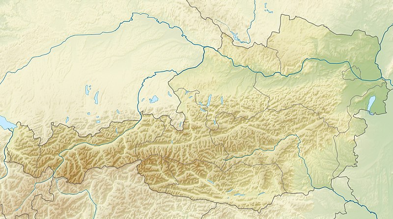
English: Location map of Austria
Equirectangular projection, N/S stretching 150 %. Geographic limits of the map:
|
| Siku | |
| Ukaboni | Chinthu chane |
| Mlembi | Uwe Dedering |
| Other versions |
Derivative works of this file: ÖRF 2011.png
|

Chilolezo
I, the copyright holder of this work, hereby publish it under the following licenses:
Chinthu ichi ntchakuzomelezgeka na Creative Commons Attribution-Share Alike 3.0 Unported license.
- Ndimwe ŵakuzomelezgeka:
- kugaŵa – kuti mutandazge, kugaŵa na kusintha ntchito
- kusazga – kusintha chito iyi
- Pa malango ghakulondezga agha:
- Viyambilo vya kuchita – Mukwenela kupeleka malumbo ghawemi, kupeleka linki yakutyonda ku chilolezo, kweneso yowoyaniso pala vinyake vyasintha. Mukwenela kuchita nthena mwakwenelela, kwambula kujikhalila khonde.
- mwa kugaŵana – Pala mwasazga panji mwasintha chinthu, mukwenela kuchitandazga

|
Chilolezo ntchakupelekeka pakupanga copy, kutandazga panj kusintha na malango gha GNU Free Documentation License, Version 1.2 or any later version published by the Free Software Foundation; with no Invariant Sections, no Front-Cover Texts, and no Back-Cover Texts. A copy of the license is included in the section entitled GNU Free Documentation License. |
You may select the license of your choice.

|
This map image could be re-created using vector graphics as an SVG file. This has several advantages; see Commons:Media for cleanup for more information. If an SVG form of this image is available, please upload it and afterwards replace this template with
{{vector version available|new image name}}.
It is recommended to name the SVG file “Austria relief location map.svg”—then the template Vector version available (or Vva) does not need the new image name parameter. |


Mbili ya chinthu
Dofyani pa siku/nyengo kuti muone umo vikaonekela pa nyengo iyo.
| Siku/Nyengo | Kachithuzi | Vipimo | Mgwiliski | Ganizo | |
|---|---|---|---|---|---|
| sono | 09:14, 28 Juni 2010 | | 1,256 × 700 (677 KB) | Uwe Dedering | very little border change |
| 12:24, 26 Epulelo 2010 |  | 1,256 × 700 (677 KB) | Uwe Dedering | rhine | |
| 12:54, 24 Epulelo 2010 |  | 1,256 × 700 (676 KB) | Uwe Dedering | {{Information |Description={{en|1=Location map of Austria}} Equirectangular projection, N/S stretching 150 %. Geographic limits of the map: * N: 49.2° N * S: 46.3° N * W: 9.4° E * E: 17.2° E Made with Natural Earth. Free |
Magwiliskilo ntchito
The following 2 pages use this file:
Umo chinthu chagwiliskikila ntchito
Ma wiki ghanyake agho ghakugwiliska ichi:
- Magwiliskilo pa ab.wikipedia.org
- Magwiliskilo pa als.wikipedia.org
- Magwiliskilo pa am.wikipedia.org
- Magwiliskilo pa an.wikipedia.org
- Magwiliskilo pa ar.wikipedia.org
- Magwiliskilo pa arz.wikipedia.org
- Magwiliskilo pa ast.wikipedia.org
- Magwiliskilo pa as.wikipedia.org
- Magwiliskilo pa azb.wikipedia.org
- Magwiliskilo pa az.wikipedia.org
- Magwiliskilo pa ban.wikipedia.org
- Magwiliskilo pa ba.wikipedia.org
- Magwiliskilo pa be-tarask.wikipedia.org
- Magwiliskilo pa be.wikipedia.org
- Magwiliskilo pa bh.wikipedia.org
Wonani magwiliskilo ghanandi ghapa charu gha chinthu ichi.